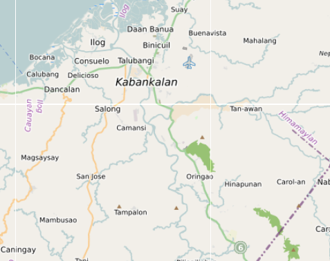
Kabankalan Map (Orientation + Daily-Life Places)
How Kabankalan Actually Works (Map + Daily-Life Guide)
Kabankalan sits in the southern plains of Negros Occidental, along the highway corridor that connects Himamaylan, Ilog, Cauayan, Sipalay, and Hinoba-an.
On a map the city looks compact, but daily life spreads outward through barangay clusters, farming plains, and coastal communities rather than concentrating in a dense downtown.
Understanding that layout makes Kabankalan much easier to navigate.
This interactive map brings together a wide range of mapped places across the Kabankalan area — including barangays, services, markets, transport points, schools, churches, and everyday infrastructure.
Instead of focusing only on attractions, the map highlights the locations that shape how daily life actually works here.
The goal is not to create a sightseeing checklist.
It is to make the structure of the city easier to understand.
What This Map Contains
The Kabankalan map combines different types of locations drawn from open mapping data and local observation.
Depending on the layer, the map includes:
- barangays and neighborhood clusters
- cafés, eateries, and small food stalls
- grocery stores and supply shops
- pharmacies and medical services
- schools, churches, and public buildings
- fuel stations and roadside services
- markets and commercial streets
- rural road connections to surrounding towns
Together these locations show the practical structure of everyday life in Kabankalan.
The map works best as an orientation guide rather than a list of attractions.
The City Core: Markets, Services, and Everyday Movement
Kabankalan’s daily activity centers around the commercial streets near Kabankalan Public Market, the Kabankalan City Hall area, and the surrounding neighborhoods of Barangay 4 and Barangay 5.
Here the map shows clusters of everyday services such as:
- the Kabankalan Public Market
- grocery and supply stores
- pharmacies and clinics
- banks and ATM areas
- bakeries and small eateries
This area forms the city’s most practical hub.
It is where residents handle daily errands, food shopping, and basic services.
Best visited:
- early morning for the market
- mid-morning for errands
- late afternoon when the heat begins to drop
Barangay Clusters: Where Most People Actually Live
Like many cities in Negros, Kabankalan spreads through a network of barangays rather than a dense urban center.
Residential areas extend outward through barangays such as:
- Hilamonan
- Orong
- Talubangi
- Magballo
- Binicuil
- Daan Banwa
These areas contain most of the city’s daily life.
Within these barangays the map reveals:
- small sari-sari stores
- local schools and churches
- basketball courts and community halls
- roadside food stalls and neighborhood eateries
Movement between barangays usually happens along smaller connecting roads rather than major highways.
The Coastal Edge: Fishing Communities and Shoreline Life
West of Kabankalan the landscape gradually approaches the Sulu Sea coastline.
Along this coastal belt the map highlights fishing communities and shoreline barangays that connect the city with nearby towns such as Ilog and Cauayan.
These areas tend to revolve around:
- small fishing boats and landing points
- coastal village markets
- simple seafood cooking traditions
- local transport routes between coastal barangays
The coast here is not built around resorts.
Instead it reflects everyday coastal life and working fishing communities.
The Agricultural Plains: The Sugar and Rice Landscape
Kabankalan sits inside the wider agricultural belt of southern Negros Occidental.
Outside the town center the map reveals a landscape dominated by:
- sugarcane plantations
- rice paddies
- irrigation canals
- farm roads connecting rural barangays
This farming landscape shapes the rhythm of the region.
Many of the roads around Kabankalan exist primarily to connect farms, villages, and markets rather than tourist sites.
Transport Corridors: The Southern Negros Highway
Kabankalan lies along the provincial highway that links much of southern Negros.
This road corridor connects the city with:
- Himamaylan to the north
- Ilog and Cauayan nearby
- Sipalay further south
- Hinoba-an near the southern end of the island
Another important inland route leads toward Mabinay in Negros Oriental, linking the west coast with the eastern side of the island.
Because of these routes, Kabankalan often functions as a regional movement hub rather than a tourist destination.
What the Map Reveals
- commercial activity clusters around the public market
- residential life spreads through multiple barangays
- farmland surrounds the city on nearly all sides
- fishing communities appear along the western coastline
- provincial roads connect the city to surrounding towns
Kabankalan is not structured as a single compact city.
It functions as a network of barangays connected by farming, markets, and road corridors.
Understanding that structure makes the area much easier to navigate.
Decision Framework
- Market access → stay near Kabankalan Public Market
- Local neighborhood life → explore Hilamonan or Talubangi barangays
- Coastal villages → travel west toward Ilog or Cauayan
- Countryside drives → explore the agricultural plains around the city
- Island travel → use Kabankalan as a stop along the southern Negros highway
Slow-Pacing Reality
- early market visits
- morning errands before the heat
- afternoon countryside drives
- evening food stalls near town centers
It does not reward:
- tightly packed itineraries
- long midday walks in the heat
- assuming short distances are always quick to travel
Heat, agriculture, and local routines shape how people move here.
The Bigger Picture
- city market core
- barangay neighborhoods
- farming plains
- coastal fishing villages
- regional road corridors
Understanding those layers turns Kabankalan from a simple stop on the highway into a place that fits naturally into the wider landscape of southern Negros Island.