Negros Island Slow Food – How the Island’s Food System Actually Works
Sugar & Muscovado (10)
Sugarcane defines the visual landscape of Negros Occidental more than any other crop. The industrial sugar belt runs north from Bacolod through Talisay, Silay, EB Magalona, Victorias, Manapla, Escalante, and San Carlos, and south through Bago, La Carlota, and La Castellana. Muscovado — the unrefined sugar produced before industrial milling — survives in specific zones where the traditional process has been maintained.
- Victorias Sugar Mill Zone — Victorias Milling Company, one of the largest mills in the Philippines
- La Carlota Sugar Mill Area — central Occidental corridor mill
- Talisay Sugarcane Belt — farms forming the northern sugar landscape
- Bago Sugarcane Belt — sugarcane growing area in the Bago plains
- Escalante Sugarcane Belt — coastal plain north of Bacolod
- Manapla Muscovado Heritage Area — strongest muscovado tradition on the island
- La Castellana Muscovado Area — upland barangay muscovado production
- Kabankalan Muscovado Area — upland barangay production south
- Canlaon Muscovado Producer Area — small-scale production in the Canlaon foothills
- Muscovado Producer Area — Bais / North Canlaon Side
Seaweed Farming (7)
Seaweed is cultivated, harvested, and dried in specific coastal zones on both sides of the island before moving into processing and export supply chains. Farming concentrates around protected bays and reef edges where conditions allow cultivation. Drying happens on shoreline areas near the growing zones.
- Sagay Seaweed Farming Area — cultivation in the waters around Sagay Marine Reserve
- Escalante Seaweed Area — north coast farming
- Bais Seaweed Farming Area — cultivation in the Bais bay area
- Tanjay Seaweed Area — coastal barangays of Tanjay
- Zamboanguita Seaweed Area — seasonal drying and collection zone
- Hinoba-an Seaweed Harvest Area — seasonal collection and drying, west coast
- Sipalay Seaweed Harvest Area — seasonal collection along Sipalay coast
Root Crops & Chilli (21)
Cassava, gabi, camote, and native chili are grown across the upland and foothill barangays of both provinces. Don Salvador Benedicto is the most concentrated vegetable and root crop zone on the island, supplying Bacolod daily. The karst uplands of Mabinay and the Valencia highlands are the other main zones. Native chili — distinct from commercial varieties — is cultivated in backyard plots for local cooking.
- Don Salvador Benedicto Vegetable Belt — camote, gabi, cassava, upland vegetables supplying Bacolod
- Canlaon Upland Vegetable Area — root crops and vegetables in mountain barangays
- Valencia Upland Root Crop Belt — gabi, cassava, camote in Valencia uplands
- Mabinay Root Crop Zone — cassava and gabi in karst upland barangays
- Tayasan Root Crop Belt — upland root crop farming
- Tanjay Upland Root Crop Area — cassava and gabi, Tanjay uplands
- Sibulan Root Crop Area — foothill barangay farming
- Amlan Root Crop Zone — cassava and gabi, Amlan uplands
- Guihulngan Root Crop Area — upland barangays behind the Guihulngan coast
- Zamboanguita Root Crop Farms — upland barangay farms
- Siaton Upland Root Crop Area — farms supplying Siaton and Zamboanguita markets
- Siaton Cassava Drying Area — cassava drying slabs used by upland households
- Sipalay Root Crop Area — cassava and camote, rural barangays
- Ilog Root Crop Area — cassava and gabi in Ilog hinterlands
- Kabankalan Root Crop Area — cassava and camote, Kabankalan hinterlands
- Hinoba-an Root Crop Zone — cassava and camote, southern Negros
- Bacong Native Ginger Area — backyard ginger for local cooking
- Sibulan Backyard Chili Area — backyard native chili cultivation
- Ilog Native Chili Area — backyard chili, rural Ilog
- Siaton Native Chili Area — backyard chili, upland Siaton
- Hinoba-an Native Chili Area — backyard native chili, coastal barangays
Slow Food Eateries (13)
The eateries layer covers specific places that connect directly to the food system the map documents — places that use local ingredients, reflect a local food tradition, or show how a particular food type has moved from barangay production into a named location. It is not a comprehensive restaurant list.
- Manokan Country — classic Bacolod inasal cluster, the strongest single traditional food landmark on the island
- Bacolod Inasal District — the broader chicken inasal area in Bacolod
- Chicken House — well-known Bacolod inasal restaurant
- Bacolod Lacson Street Food Corridor — urban food culture layer, Bacolod
- Silay Heritage District Restaurants Area — heritage-house dining and traditional food in Silay
- Gabby’s Bistro — long-running Dumaguete restaurant, Filipino dishes
- Aboy’s Restaurant — Dumaguete, grilled seafood and local meals
- Sans Rival Bistro — Dumaguete, local dessert culture and everyday city eating
- Buglas Isla Cafe — Dumaguete, local-ingredient kitchen
- Cafe 1925 — Dumaguete, heritage-style cafe
- Dumaguete Native Coffee Stalls — local coffee using native beans
- Kabankalan Local Eatery Zone — roadside and market-adjacent eating, southern Negros
- Sipalay Local Food Area — beach-adjacent food, fresh catch and local cooking
Local Food Markets (35)
Public markets are the clearest entry point into how the island feeds itself. Every municipality has one. They pull produce from surrounding barangays, connect coastal supply with inland demand, and redistribute daily. The Malatapay Market in Zamboanguita operates Wednesdays only — a traditional market different in character from the daily municipal markets.
- Bacolod Central Market — largest market on the island, draws produce from across the province
- Dumaguete Public Market — main east coast market, fish, vegetables, rice, spices
- Malatapay Market — Wednesday only, Zamboanguita; produce, seafood, livestock, woven goods
- Kabankalan Public Market — main supply point for southern interior
- San Carlos City Public Market — northern Negros, farm, port, and kitchen connections
- Cadiz Public Market, Cadiz Fish Port — northern fishing port and market
- Sagay Public Market, Escalante Public Market — north coast markets
- EB Magalona Public Market, Victorias Public Market — sugar belt town markets
- Manapla Public Market, Talisay Public Market — northern corridor
- Silay Public Market — heritage town market
- La Carlota Public Market, La Castellana Public Market — central Occidental
- Bago Public Market — agricultural areas south of Bacolod
- Himamaylan Public Market, Guihulngan Public Market — mid-island markets
- Bayawan Public Market — southern Negros Oriental, farm and fishing connections
- Tanjay Public Market — Tanjay coast and uplands
- Bais Public Market — Bais bay area
- Siaton Public Market — southern Negros Oriental
- Canlaon Public Market — mountain town market, both provincial sides
- Don Salvador Benedicto Market — highland market receiving upland vegetable produce
- Valencia Market Area — upland market serving Valencia farms and Dumaguete
- Amlan Public Market Area — everyday food rhythms, small coastal market
- Bacolod Lacson Street Food Area — Bacolod urban food corridor
- Dumaguete Boulevard Food Stalls Area — evening street food and grill area
- Dauin Roadside Vegetable Stall Area — roadside produce, Dauin to Dumaguete corridor
- Sipalay Seafood Grill Area — beach town fresh catch to roadside cooking
- San Carlos Port / Market Food Area — port-adjacent market trade and seafood
- Manokan Country — Bacolod inasal cluster, market-food tradition
Local Food Produce (14)
The produce layer covers herbs, medicinal plants, native sweets, kakanin, and wild honey — the traditional and household-level food production that moves within communities rather than through formal supply chains. Kakanin and native desserts are produced at the barangay level across the island, most visibly in Dumaguete and Bacolod.
- Dumaguete Native Dessert Belt — cluster of native dessert makers
- Dumaguete Native Dessert Makers — small-scale puto, biko, sapin-sapin, bibingka producers
- Bacolod Native Kakanin Belt — Bacolod’s appetite for rice-based sweets
- Talisay Native Dessert Area — traditional sweet makers
- Kabankalan Native Sweet Makers — barangay-level native sweet production
- Sipalay Native Dessert Makers — kakanin and native sweet makers
- Valencia Wild Honey Area — wild honeybee gathering zones in Valencia uplands
- Canlaon Wild Honey Area — seasonal collection in forest barangays around Kanlaon volcano
- Valencia Herb & Medicinal Plant Area — herb gardens and medicinal plants in upland barangays
- Don Salvador Benedicto Herb Gardens — highland herb cultivation
- Dumaguete Backyard Herb Gardens — small herb gardens in residential areas
- Sibulan Backyard Herb Gardens — barangay-level herb and medicinal plant gardens
- Hinoba-an Herb Garden Area — backyard herb gardens, coastal barangays
- Mabinay Herb & Medicinal Plant Area — medicinal plants in karst upland zones
Fruit Belts (11)
Fruit trees are the most widespread element of the food map — backyard mango, guava, calamansi, santol, duhat, rambutan across the residential barangays of almost every municipality. The mapped belts represent areas where concentration is high enough to be visible as an agricultural zone rather than scattered backyard planting.
- Amlan Fruit Belt — mango and rambutan orchards, one of the more developed fruit zones
- Hinoba-an Fruit Belt — mango and banana orchards, southern Negros
- Sibulan Native Fruit Belt — duhat, santol, and mango backyard trees
- Dumaguete Backyard Fruit Trees Area — mango, guava, and calamansi in residential zones
- Bacong Fruit Trees Area — backyard fruit trees, coastal barangays
- Dauin Native Fruit Trees — mango, guava, and santol backyard trees
- Kabankalan Backyard Fruit Trees — mango, guava, and banana, rural barangays
- Sipalay Fruit Trees Area — backyard fruit trees, rural Sipalay
- Cauayan Native Fruit Trees — backyard fruit trees, coastal barangays
- Zamboanguita Fruit Trees Area — backyard fruit trees, coastal barangays
- Basay Native Fruit Belt — mixed fruit trees, rural Basay
Fishing Villages & Grounds (31)
Both coasts of Negros Island are active fishing coasts with different characters. The east coast from Guihulngan south through Sibulan, Bacong, Dauin, and Zamboanguita is a constant small-boat fishing coast. The west coast from Cadiz south through Escalante, Himamaylan, Cauayan, Hinoba-an, and Sipalay is longer and less concentrated but equally active. Fish drying is visible along both coast roads — the preserved supply that extends catch beyond immediate local consumption.
- Cadiz Fish Port — significant landing and trading point, northern Negros
- Cadiz Coastal Fishing Grounds — fishing grounds feeding Cadiz markets and fish port
- Manapla Fish Landing Area — coastal barangay landing point
- Victorias Coastal Fishing Area — small-scale fishing, Victorias shoreline
- Escalante Fish Landing Area, Escalante Coastal Fishing Villages — north coast
- Escalante Fish Drying Belt — fish drying along the north coast road
- Sagay Coastal Fishing Grounds, Sagay Coastal Fish Drying Area
- Himamaylan Coastal Fishing Grounds, Himamaylan Fish Drying Belt — mid-west coast
- Talisay Fish Landing Area — coast south of Bacolod
- Hinoba-an Coastal Fishing Grounds — small-scale, feeding local grills and markets
- Cauayan Coastal Fishing Villages, Cauayan Fish Drying Area — Cauayan coastline
- Sipalay Coastal Fishing Grounds, Sipalay Fish Landing Area — feeds beach grills
- Guihulngan Fish Landing Area, Guihulngan Fish Drying Zone — north-east coast
- Bais Fish Landing & Seafood Area — Bais bay fishing grounds
- Tanjay Coastal Fishing Grounds, Tanjay Fish Drying Area — Tanjay coast road
- Bacong Fish Landing Area, Dauin Fish Landing Area — east coast landings
- Amlan Fish Landing Area — outrigger fishermen, Amlan
- Siaton Coastal Fishing Villages — cluster of small fishing villages
- Kabankalan River Fishing Area, Ilog River Fishing Area — west coast rivers
- Cauayan River Fishing Area, Basay River Fishing Area — river fishing, southern west
- Mabinay River Fishing Area — upland river fishing, Mabinay
- Basay Fish Drying Area — traditional fish drying, coastal households
Farms & Producers (22)
The farms layer covers the production zones that supply the island’s markets — rice plains, organic farms, vegetable belts, mixed foothill farms, and the organisations that connect producers to buyers. Alter Trade Foundation in Bacolod is the only formally mapped organisation, representing the muscovado-to-fair-trade supply chain.
- Alter Trade Foundation — fair-trade organisation, muscovado and farmer support, Bacolod
- Fresh Start Organic Farm Area — organic vegetables, herbs, eggs, Bago
- Masaplod Norte Organic Farm Area — organic and permaculture, Dauin; vegetables, cacao, coconuts
- Don Salvador Benedicto Organic Farm Area — highland barangay farms supplying Bacolod
- Murcia Vegetable Farm Belt, Murcia Vegetable & Fruit Farms — foothill farms, Bacolod supply
- Canlaon Mountain Farm Zone — vegetables, root crops, and fruit in foothill barangays
- Valencia Mountain Farms Area — upland farm zone, Dumaguete and Valencia market supply
- Mabinay Upland Farm Zone — karst upland barangay farming
- Tayasan Upland Farm Area — mixed upland farming
- Amlan Organic Vegetable Farms Area, Amlan Community Vegetable Gardens
- Bago Rice Plains — lowland rice fields, main grain belt
- Escalante Rice & Sugarcane Belt — mixed rice and sugarcane farms
- Ilog Rice & Corn Belt — rice and corn supplying Kabankalan and Ilog
- Bayawan Corn Belt, Bayawan Rice Drying Area, Bayawan Upland Vegetable Area
- La Castellana Farm Area, La Castellana Sugarcane & Fruit Area — foothill edge of sugar belt
- Talisay Coconut & Fruit Area — mixed coconut and fruit farms
- Amlan Banana & Root Crop Area — banana and cassava farms supplying Amlan and Dumaguete
Coconut Vinegar (10)
Coconut vinegar is produced across both provinces at the household level — tuba collected from the palm flower, allowed to sour into vinegar through traditional fermentation. It moves through personal networks, local markets, and informal selling rather than formal retail. The sourness is distinct from commercially produced cane vinegar and specific to dishes cooked in the barangays that produce it.
- Bacong Coconut Vinegar Makers — traditional producers in Bacong coastal barangays
- Amlan Coconut Vinegar Area — rural barangay production
- Siaton Coconut Vinegar Area — coastal and upland Siaton barangays
- Zamboanguita Coconut Vinegar Area — backyard production, upland barangays
- Bayawan Coconut Vinegar Area — rural barangay production
- Himamaylan Coconut Vinegar Area — mid-west coast barangays
- Ilog Coconut Vinegar Area — Ilog barangay production
- Cauayan Coconut Vinegar Area — coastal barangay production
- Kabankalan Coconut Vinegar Area, Kabankalan Coconut Vinegar Belt — rural and upland Kabankalan
Cacao & Tablea (10)
Cacao grows across the island mostly in small quantities — backyard trees, barangay-scale plots, and small farms supplying local tablea makers. Tablea — compressed discs of roasted ground cacao for native chocolate drinks — is produced at the barangay level across the upland and foothill zones. The Valencia cacao and tablea zone is the most concentrated on the east side. Production moves within communities and through local markets rather than through export supply chains.
- Valencia Cacao / Tablea Area — most developed cacao zone outside the formal sector, east side
- Valencia Backyard Cacao Zone — backyard trees and informal tablea production around Valencia
- Murcia Backyard Cacao Area — backyard cacao and smallholder tablea traditions
- Dauin Backyard Tablea Makers — small-scale backyard cacao and tablea producers
- Canlaon Cacao Area — cacao growing in mountain barangays
- Don Salvador Benedicto Cacao Belt — highland farming barangay cacao cultivation
- Himamaylan Cacao Area — backyard and small-farm cacao, Himamaylan uplands
- Kabankalan Cacao Area — upland barangay cacao growing
- Tayasan Cacao Area — upland cacao cultivation
- Mabinay Cacao Zone — cacao in the karst upland barangays
Banana & Coconut Belts (19)
Banana and coconut run alongside each other across almost the entire island as background crops — present in most barangays, supplying local consumption and feeding into the vinegar, copra, and informal produce trade. The mapped belts represent areas where concentration is dense enough to function as a visible agricultural zone.
- Valencia Banana Belt — banana farms in Valencia uplands
- Dauin Banana Belt, Dauin Coconut Belt — Dauin uplands
- Bacong Banana Belt — farms supplying Dumaguete and Bacong
- Sibulan Coconut Belt — coconut groves used for vinegar and copra
- Siaton Banana Belt — farms supplying Siaton and nearby markets
- Zamboanguita banana and coconut — coastal and upland barangays
- Tanjay Banana & Coconut Area — east coast belt
- Guihulngan Banana Belt — east coast
- Sagay Coconut Belt — northern Negros Occidental
- Escalante Banana & Coconut Belt — north coast mixed belt
- Don Salvador Benedicto Banana Belt — highland farming zone
- Mabinay Coconut & Banana Area — karst upland area
- Kabankalan Banana Belt — Kabankalan hinterlands
- Ilog Coconut Belt — coconut groves for vinegar and copra
- Cauayan Banana Belt, Cauayan Coconut Belt — Cauayan coastal barangays
- Hinoba-an Banana Belt — southern Negros supply
- Sipalay Coconut Belt — coastal Sipalay
- Basay Coconut Drying Area — copra-related activity near coastal barangays
Dumaguete–Valencia Food Belt (38)
The Dumaguete–Valencia corridor is the most food-diverse zone on the east coast. Dumaguete is the main market and distribution hub; Valencia above it supplies the upland produce — cacao, root crops, vegetables, fruit, and herbs — that feeds down into Dumaguete’s markets and restaurants. The coastal municipalities of Sibulan, Bacong, Amlan, and Dauin form the immediate supply ring around the city.
- Dumaguete Public Market — main east coast market hub
- Dumaguete Boulevard Food Stalls Area, Dumaguete Native Coffee Stalls
- Dumaguete Native Dessert Belt, Dumaguete Native Dessert Makers
- Dumaguete Backyard Fruit Trees Area, Dumaguete Backyard Herb Gardens
- Valencia Market Area — upland market serving farms and Dumaguete
- Valencia Mountain Farms Area — vegetables, fruit, and cacao supply
- Valencia Cacao / Tablea Area, Valencia Backyard Cacao Zone
- Valencia Upland Root Crop Belt — gabi, cassava, camote
- Valencia Banana Belt, Valencia Herb & Medicinal Plant Area
- Valencia Wild Honey Area
- Sibulan Root Crop Area, Sibulan Coconut Belt, Sibulan Native Fruit Belt
- Sibulan Backyard Chili Area, Sibulan Backyard Herb Gardens
- Bacong Fish Landing Area, Bacong Banana Belt, Bacong Coconut Vinegar Makers
- Bacong Fruit Trees Area, Bacong Native Ginger Area
- Amlan Public Market Area, Amlan Root Crop Zone, Amlan Fruit Belt
- Amlan Organic Vegetable Farms Area, Amlan Coconut Vinegar Area
- Amlan Community Vegetable Gardens, Amlan Banana & Root Crop Area
- Dauin Fish Landing Area, Dauin Roadside Vegetable Stall Area
- Dauin Backyard Tablea Makers, Dauin Banana Belt, Dauin Coconut Belt, Dauin Native Fruit Trees
- Masaplod Norte Organic Farm Area — organic and permaculture, Dauin
Northern Sugar & Seafood Corridor (36)
The northern corridor runs from Bacolod north through Talisay, Silay, EB Magalona, Victorias, Manapla, Cadiz, Escalante, and San Carlos. It combines the densest concentration of sugar infrastructure on the island with active fishing along the Visayan Sea coast and the municipal markets that serve the sugar belt towns.
- Bacolod Central Market — main island market hub
- Bacolod Inasal District, Manokan Country, Chicken House, Bacolod Lacson Street Food Corridor
- Bacolod Native Kakanin Belt, Alter Trade Foundation
- Talisay Sugarcane Belt, Talisay Public Market, Talisay Coconut & Fruit Area, Talisay Fish Landing Area, Talisay Native Dessert Area
- Silay Sugarcane (part of belt), Silay Public Market, Silay Heritage District Restaurants Area
- EB Magalona Public Market
- Victorias Sugar Mill Zone, Victorias Public Market, Victorias Coastal Fishing Area
- Manapla Muscovado Heritage Area, Manapla Public Market, Manapla Fish Landing Area
- Cadiz Fish Port, Cadiz Public Market, Cadiz Coastal Fishing Grounds
- Escalante Sugarcane Belt, Escalante Public Market, Escalante Seaweed Area
- Escalante Fish Landing Area, Escalante Coastal Fishing Villages, Escalante Fish Drying Belt
- Escalante Rice & Sugarcane Belt, Escalante Banana & Coconut Belt
- Sagay Public Market, Sagay Seaweed Farming Area, Sagay Coastal Fishing Grounds, Sagay Coastal Fish Drying Area, Sagay Coconut Belt
- San Carlos City Public Market, San Carlos Port / Market Food Area
- Bago Public Market, Bago Rice Plains, Fresh Start Organic Farm Area
- La Carlota Sugar Mill Area, La Carlota Public Market
- La Castellana Muscovado Area, La Castellana Public Market, La Castellana Farm Area, La Castellana Sugarcane & Fruit Area
- Murcia Vegetable & Fruit Farms, Murcia Vegetable Farm Belt, Murcia Backyard Cacao Area
- Canlaon Public Market, Canlaon Mountain Farm Zone, Canlaon Cacao Area, Canlaon Wild Honey Area, Canlaon Upland Vegetable Area, Canlaon Muscovado Producer Area
- Don Salvador Benedicto Market, Don Salvador Benedicto Vegetable Belt, Don Salvador Benedicto Organic Farm Area, Don Salvador Benedicto Cacao Belt, Don Salvador Benedicto Herb Gardens, Don Salvador Benedicto Banana Belt
Southern Uplands & Coastal Food Chain (31)
The southern uplands corridor covers the food systems of the interior and coastal municipalities on the Negros Oriental side — from Guihulngan south through Bais, Tanjay, Tayasan, Jimalalud, Mabinay, Siaton, and Zamboanguita. This is the least visible part of the island’s food system from the outside but supports substantial production of root crops, cacao, vinegar, and coastal fishing.
- Guihulngan Public Market, Guihulngan Fish Landing Area, Guihulngan Fish Drying Zone, Guihulngan Banana Belt, Guihulngan Root Crop Area
- Bais Public Market, Bais Fish Landing & Seafood Area, Bais Seaweed Farming Area, Muscovado Producer Area — Bais/Canlaon
- Tanjay Public Market, Tanjay Coastal Fishing Grounds, Tanjay Fish Drying Area, Tanjay Seaweed Area, Tanjay Upland Root Crop Area, Tanjay Banana & Coconut Area
- Tayasan Root Crop Belt, Tayasan Upland Farm Area, Tayasan Cacao Area
- Mabinay Root Crop Zone, Mabinay Upland Farm Zone, Mabinay Cacao Zone, Mabinay Coconut & Banana Area, Mabinay Herb & Medicinal Plant Area, Mabinay River Fishing Area
- Bayawan Public Market (two entries), Bayawan Corn Belt, Bayawan Coconut Vinegar Area, Bayawan Rice Drying Area, Bayawan Upland Vegetable Area
- Siaton Public Market, Siaton Coastal Fishing Villages, Siaton Banana Belt, Siaton Cassava Drying Area, Siaton Native Chili Area, Siaton Upland Root Crop Area, Siaton Coconut Vinegar Area
- Zamboanguita Seaweed Area, Zamboanguita Root Crop Farms, Zamboanguita Coconut Vinegar Area, Zamboanguita Fruit Trees Area, Malatapay Market
Western Coastal Food Chain (29)
The western coastal chain runs south from Kabankalan through Himamaylan, Ilog, Cauayan, Hinoba-an, and Sipalay to Basay at the island’s southern tip. This is the longest and most varied food corridor on the western side — fishing coastline, coconut vinegar production, root crop uplands, cacao zones, and the beach-to-grill food culture of Sipalay.
- Kabankalan Public Market, Kabankalan Root Crop Area, Kabankalan Banana Belt, Kabankalan Backyard Fruit Trees, Kabankalan Coconut Vinegar Area, Kabankalan Coconut Vinegar Belt, Kabankalan Cacao Area, Kabankalan Muscovado Area, Kabankalan River Fishing Area, Kabankalan Native Sweet Makers
- Himamaylan Public Market, Himamaylan Coastal Fishing Grounds, Himamaylan Fish Drying Belt, Himamaylan Coconut Vinegar Area, Himamaylan Cacao Area
- Ilog Root Crop Area, Ilog Rice & Corn Belt, Ilog Coconut Belt, Ilog Native Chili Area, Ilog River Fishing Area, Ilog Coconut Vinegar Area
- Cauayan Coastal Fishing Villages, Cauayan Fish Drying Area, Cauayan River Fishing Area, Cauayan Banana Belt, Cauayan Coconut Belt, Cauayan Coconut Vinegar Area, Cauayan Native Fruit Trees
- Hinoba-an Coastal Fishing Grounds, Hinoba-an Root Crop Zone, Hinoba-an Seaweed Harvest Area, Hinoba-an Native Chili Area, Hinoba-an Banana Belt, Hinoba-an Fruit Belt, Hinoba-an Herb Garden Area
- Sipalay Coastal Fishing Grounds, Sipalay Fish Landing Area, Sipalay Seafood Grill Area, Sipalay Root Crop Area, Sipalay Coconut Belt, Sipalay Seaweed Harvest Area, Sipalay Fruit Trees Area, Sipalay Native Dessert Makers, Sipalay Local Food Area
- Basay Fish Drying Area, Basay River Fishing Area, Basay Coconut Drying Area, Basay Native Fruit Belt
Negros Island Slow Food – How the Island’s Food System Actually Works
Negros Island produces more food than most people passing through it realise.
The sugar that defines the island’s identity in official narratives is only part of it. Underneath the sugarcane belt and around its edges — in upland barangays, along both coasts, in river valleys, and in backyard plots across almost every municipality — a wider food system operates through coconut, cacao, root crops, fish, vinegar, fruit, seaweed, and native produce that rarely makes it onto a tourist menu or a government report.
This map documents that system. Not restaurants in the conventional sense. The sources, the producers, the landing points, the drying areas, the markets, and the places where food moves from land or sea into the daily supply chain of a town.
How Food Moves on Negros Island
The island’s food system does not move through a single centre. It moves through a network of public markets — one in almost every municipality — that pull produce from surrounding barangays, connect coastal supply with inland demand, and redistribute daily across the town.
Public markets are the clearest entry point into how the island feeds itself. Bacolod Central Market is the largest, drawing produce, seafood, meat, and processed goods from across the province. Dumaguete Public Market does the same for the east coast, with fish from the Tañon Strait coast, vegetables from Valencia and the upland barangays, and processed goods moving both ways. The Malatapay Market in Zamboanguita operates on Wednesdays only — a traditional market drawing in produce, livestock, seafood, and woven goods from the surrounding coastal and upland barangays in a way that the daily municipal markets don’t replicate.
Beyond the main towns, every municipality has its own market. Don Salvador Benedicto’s highland market receives vegetable produce from mountain barangays that supply Bacolod. Canlaon’s market draws from foothill farming communities on both the Occidental and Oriental sides of the mountain zone. Kabankalan’s market serves as the main supply point for the southern interior. These are not tourist stops — they are the functional nodes through which food from farms and boats reaches the people who eat it.
The Fishing Coast
Both coasts of Negros Island are active fishing coasts, with different characters on each side.
The east coast — from Guihulngan south through Sibulan, Bacong, Dauin, and Zamboanguita — is a constant fishing coast where small outrigger boats operate from barangay beach access points. Fish landings in Bacong, Dauin, and Amlan supply the local market chain through Dumaguete and the surrounding municipalities. The Bais bay area on the east coast is known for its fishing grounds and fish landing, with seafood feeding markets in Bais, Tanjay, and south toward Dumaguete.
The west coast — Cadiz, Escalante, Victorias, Manapla, Himamaylan, Cauayan, Hinoba-an, and Sipalay — is a longer and less concentrated fishing coast but no less active. The Cadiz fish port at the north is one of the more significant landing and trading points on the island. Escalante’s fish landing feeds the north coast corridor. Further south, Sipalay’s coastal fishing grounds supply the local seafood grill area — the direct connection between morning catch and roadside cooking that defines coastal food in the south.
Fish drying is the visible marker of how catch moves into preserved supply. Drying areas appear along the coast road in Cauayan, Basay, Sagay, Escalante, Tanjay, Guihulngan, and Himamaylan — fish laid out on road shoulders, fences, or raised racks for a few hours, then cleared. The timing and location are consistent. These are not informal — they are part of the production chain.
River fishing adds another layer to the interior and coastal municipalities. The Ilog, Kabankalan, Cauayan, Basay, and Mabinay rivers are all active fishing grounds for local households. The catch from river fishing rarely reaches the public market — it stays within the barangay or is traded informally between neighbours.
Seaweed farming operates in specific coastal zones. Hinoba-an and Sipalay on the west coast, Zamboanguita and Tanjay on the east, Sagay and Escalante in the north — these are the areas where seaweed is cultivated, harvested, and dried before moving into the supply chain for processing and export.
The Sugar Belt and Muscovado
Sugarcane defines the visual landscape of Negros Occidental in a way that no other crop does anywhere else in the Philippines. The belt runs from Bacolod north through Talisay, Silay, EB Magalona, Victorias, Manapla, Cadiz, Escalante, and San Carlos, and extends south and inland through Bago, La Carlota, and La Castellana.
The Victorias Milling Company is the clearest single point on the map where the sugar system is visible as infrastructure — the mill, the surrounding housing, the truck routes, the rhythm of the surrounding barangays all oriented around its operational schedule. La Carlota’s sugar mill is a second centre further south.
Muscovado is the unrefined sugar that predates the industrial mills and continues to be produced in specific zones. Manapla has the strongest muscovado heritage on the island — the traditional process of crushing cane and reducing juice into dark unrefined sugar has been maintained there where it has disappeared elsewhere. La Castellana and Kabankalan both have muscovado production areas in the upland barangays, and the Canlaon foothill zone on the Oriental side has small-scale production that connects the mountain farming economy to the traditional sugar trade.
Alter Trade Foundation in Bacolod is the main organisation working to connect muscovado producers with fair-trade markets — the only formally mapped organisation in this layer, and one that makes the production chain from upland farm to international buyer visible in a way that individual producer pins cannot.
Cacao and Tablea
Cacao is grown across the island, mostly in small quantities — backyard trees, barangay-scale plots, and small farms that supply local tablea makers rather than export processors. The geography of cacao on Negros follows the upland and foothill zones: Valencia and Murcia on the east and interior, Dauin’s backyard tablea makers, Canlaon and Don Salvador Benedicto in the highland zone, Kabankalan, Himamaylan, Mabinay, and Tayasan further along the interior.
Tablea — the compressed discs of roasted ground cacao used to make native chocolate drinks — is produced at the barangay level across most of these areas. It moves within communities and through local markets rather than through supply chains visible to outside buyers.
The Valencia cacao and tablea zone is the most concentrated on the east side of the island. Valencia’s upland barangays have a combination of cacao trees, processing knowledge, and market access through Dumaguete that makes it one of the more developed cacao areas outside the formal sector.
Coconut Vinegar
Coconut vinegar is produced across both provinces, primarily in coastal and foothill barangays where coconut palms are accessible and the traditional fermentation process — tuba collected from the palm flower, allowed to sour into vinegar — is still practised at the household level.
The production is most concentrated along the east coast from Bacong through Amlan, Zamboanguita, Bayawan, and Siaton, and along the west coast interior in Cauayan, Ilog, Kabankalan, and Himamaylan. It is not a product that appears in supermarkets or formal retail in most of these municipalities — it moves through personal networks, local markets, and occasional small-scale selling.
The distinction between commercially produced cane vinegar and traditionally produced coconut vinegar matters for how food is cooked in the barangays that produce it. The sourness is different. The use in cooking is specific to dishes that rely on that particular character.
Root Crops and Upland Farming
Cassava, gabi, camote, and native chili are grown across the island’s upland and foothill barangays in a pattern that runs from the Valencia and Sibulan uplands on the east coast through the interior municipalities — Mabinay, Tayasan, Jimalalud — and south through Siaton, Zamboanguita, and Basay, and west through Hinoba-an, Ilog, Kabankalan, and Sipalay.
Don Salvador Benedicto is the most concentrated upland vegetable zone on the island. The highland municipality sits above the sugar belt at an elevation that allows year-round vegetable production — camote, gabi, cassava, and a range of upland vegetables that move down to Bacolod’s market daily. The road from Don Salvador Benedicto to the plains is the main route for this produce, and morning movement on it reflects the supply chain.
Canlaon’s upland vegetable area feeds the mountain town market and connects through the cross-island road to both provinces. Mabinay’s karst upland barangays produce root crops in a landscape that limits other agricultural options — cassava and gabi grow where the terrain makes conventional farming difficult.
Native chili is a separate category — backyard cultivation in Sibulan, Siaton, Ilog, and Hinoba-an that supplies local cooking rather than commercial markets. The specific varieties grown in barangay plots are distinct from commercial chili and are used in dishes that call for their particular heat and flavour.
Banana, Coconut, and Fruit Belts
Banana and coconut run alongside each other across almost the entire island as background crops — present in most barangays, supplying local consumption and feeding into the vinegar, copra, and informal produce trade. The mapped belts represent the areas where the concentration is high enough to be visible as an agricultural belt rather than scattered backyard planting.
Fruit trees are the most widespread element of the food map — backyard mango, guava, calamansi, santol, duhat, rambutan across the residential barangays of every municipality from Dumaguete to Sipalay. These are not commercial orchards. They are the background layer of the household food supply that supplements what is bought at market and rarely appears in any formal accounting of what the island produces.
Amlan’s fruit belt — mango and rambutan orchards — is one of the few areas where backyard fruit production has reached a scale visible from the road. The Hinoba-an fruit belt in the south is similar, combining mango and banana in an agricultural zone that supplies local markets and informal trade south into Siaton and Sipalay.
Local Produce and Native Foods
Medicinal plants and herbs are grown at the barangay level across the island, most visibly in the upland municipalities. Valencia’s herb and medicinal plant area, Sibulan’s backyard gardens, Hinoba-an’s herb plots, Don Salvador Benedicto’s highland herb cultivation, and Mabinay’s medicinal plant zones are all part of the same pattern — knowledge-based cultivation specific to the highland and foothill barangays where the plants grow well.
Wild honey is collected in the forest barangays around Canlaon volcano and in the Valencia uplands. The collection is seasonal and the product moves informally through local networks.
Native sweets and kakanin are produced across the island but concentrated in the areas with the strongest traditional food culture. Dumaguete has the most visible native dessert zone. Sans Rival Bistro sits within this tradition even as it operates at a different scale. Bacolod’s kakanin belt supplies the city’s appetite for rice-based sweets. Sipalay, Talisay, and Kabankalan all have native sweet makers mapped in the barangay zones where the tradition is maintained.
What the Map Shows
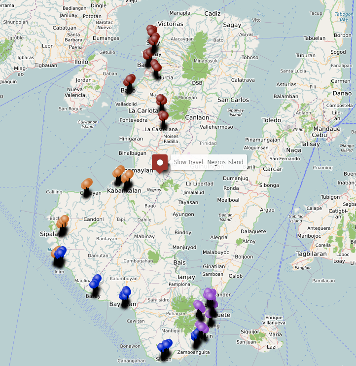
338 food system points are mapped across 17 layers covering both provinces, the island’s interior, and four geographic corridor views that show how the food systems connect across space.
Markets are the backbone — 35 across the island, from Bacolod Central to the highland market of Don Salvador Benedicto. The fishing system covers 31 points including landings, drying areas, village grounds, and river fishing. Root crops and upland produce cover 21 points across the interior and foothill zones. Banana and coconut belts cover 19 points on both coasts and the highlands. Farms and producers cover 22 points from organic operations in Bago and Dauin to foothill farms in Murcia and mountain farms in Canlaon.
The map does not show what is cooked in the barangays from what the land and sea produce. What the map shows is the structure that makes that cooking possible: where things come from, where they land, where they are traded, and how the supply moves across the island.
Related Guides
- The Insider’s Slow Map of Negros — the full map series index for Negros Island
- Negros Public Markets Map — markets across both provinces mapped in detail
- Negros Local Food Map — local food by town and zone
- Getting Around Negros Island the Slow Way — how transport connects the food producing areas to the markets
- DOI Dataset