Negros Public Markets Map (Where Town Life Happens)
Negros Island Markets Map – How It Actually Works
Markets on Negros Island are not shopping destinations. They are the points where food supply, daily movement, and local trade converge. Understanding how they work means understanding how people move through them, what they supply, and when that activity happens.
This map shows that structure across the whole island.
What the Map Shows
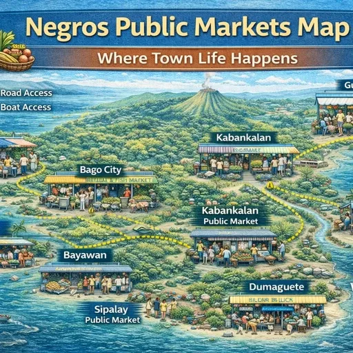
The map covers six layers of commercial activity across Negros Occidental and Negros Oriental.
Public markets form the core layer — the palengke and wet markets that anchor every municipal centre from Bacolod and Silay in the north through Kabankalan and Himamaylan on the west coast, down to Dumaguete, Tanjay, and Bais on the east. These are working markets. Activity peaks early, typically before nine in the morning, and thins out through the afternoon. Most operate daily. A smaller number run on fixed market days.
Supermarkets sit alongside the public market layer — both chain operations such as Puregold, Savemore, Lopue’s, and Robinsons, and independently run stores that serve the same municipal areas. These operate on fixed hours and carry standardised stock. They do not replace public markets. They run parallel to them, serving different purchasing patterns.
Malls and commercial centres — SM, Gaisano, CityMall, Robinsons — are concentrated in Bacolod and appear in secondary cities including Silay, Cadiz, Victorias, and Kabankalan. They function as retail anchors for the surrounding municipality rather than as destinations in themselves.
Convenience stores cover the island in a dense layer. Chain stores — 7-Eleven, Munsterific, iMart — cluster along main roads and inside urban centres. Local sari-sari stores extend that coverage into barangays where chain operations do not reach. These are not interchangeable. The sari-sari store serves immediate neighbourhood needs on credit and relationship. The chain store serves road travellers and fixed transactions.
Fuel stations follow the main road corridors — the north-south highway on the west coast and the equivalent route on the east. Coverage thins significantly on cross-island roads and in upland areas.
Retail zones mark the commercial land-use areas that OSM has recorded but where individual businesses have not been mapped. These show where commercial concentration exists even where detail is incomplete.
How the Market System Actually Works
Public markets on Negros follow a supply chain that is not always visible from the outside.
Produce arrives early. In larger markets — Bacolod Central, Dumaguete, San Carlos — wholesale movement happens before retail trading begins. Vendors who supply smaller markets further along the road buy here first. Fish arrives from landing sites along the coast, moves through the larger market, and reaches smaller municipal markets the same morning.
The west coast road is the main supply corridor. Markets in Silay, Talisay, Victorias, Cadiz, Sagay, and San Carlos receive goods that originate in Bacolod or pass through it. The east coast operates on a similar logic from Dumaguete northward through Tanjay, Bais, and Guihulngan.
Cross-island supply is thinner. Markets in inland municipalities — Kabankalan, Himamaylan, La Carlota on the west, Valencia and Mabinay on the east — draw from the nearest coastal city rather than from each other.
Specialist markets operate at the edges of this system. The fish markets at Tabao and Pontevedra handle volume that moves differently from general produce. The farmers’ and weekend markets in Bacolod draw directly from producers rather than through the wholesale chain. The distinction matters because the timing, pricing, and supply logic of each type is different.
What the Layers Reveal Together
When all six layers are visible simultaneously, the density pattern makes the supply structure legible.
Bacolod concentrates every layer — public markets, chain supermarkets, malls, convenience stores, and fuel stations all intersect there. That concentration reflects its role as the island’s main distribution node rather than simply its largest city.
Dumaguete replicates that pattern at smaller scale on the east side. Between the two cities, market coverage thins and becomes more municipal — each town serving its own catchment rather than feeding a wider corridor.
The northwest coast shows a different pattern. Public markets appear at regular intervals through Silay, Talisay, Victorias, Cadiz, and Sagay, but the commercial layer around them is thinner. This is the production zone rather than the distribution zone — farmland and fish farms concentrate here, and the markets reflect that supply rather than retail demand.
Inland municipalities show the thinnest coverage overall. A single public market, one or two small supermarkets, and local sari-sari stores form the entire commercial layer for some areas. Supply frequency is lower and the market day — where it applies — shapes activity more than daily retail does.
How to Read This Map
Use the layer toggles to move between types of commercial activity rather than viewing everything at once.
The public markets layer shows where trade concentrates by municipality. The supermarkets layer shows where fixed-hour retail has developed. Together, they show which towns have a dual commercial structure and which rely primarily on the public market.
The convenience stores layer shows density of small retail coverage — where that coverage is thin, sari-sari stores are filling the gap between the mapped points.
The fuel stations layer is also a road legibility layer. Where fuel stations cluster, the main road corridor runs. Where they disappear, the road narrows and traffic thins.