Negros Beaches Map (Best Coasts + Access Points)
Negros Island Beaches – How It Actually Works (Map + Local Guide)
Negros Island beaches are best known for long coastal stretches, small coves, village shorelines, dive access points, and the mix of developed and undeveloped coast that runs around the island.
They operate as a coastal system where beaches, barangays, marine areas, and local settlements all share the same shoreline rather than being separated into resort-only zones.
This guide explains how that system works in practice, using the map to show how these layers connect.
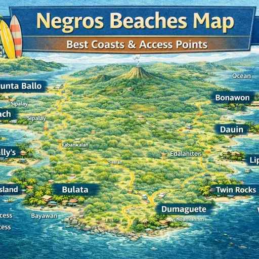
What This Map Shows
- Major beach areas across Negros Occidental and Negros Oriental including Sipalay, Cauayan, Hinoba-an, San Carlos, Dumaguete, Dauin, and Zamboanguita
- Known beaches such as Sugar Beach, Punta Ballo, Campomanes Bay, Salagdoong Beach, Paliton Beach, Dauin coastlines, and Zamboanguita shoreline areas
- Coastal barangays where beaches sit within working communities rather than isolated resorts
- Marine access points, snorkelling zones, and shoreline entry areas
- Smaller and lesser-known beaches spread along the coastline
- Roads and routes connecting beach areas to nearby towns and barangays
How to Use This Map
The beaches map works best when you read it as a continuous coastline rather than a collection of separate beach destinations.
Each beach connects to a barangay, and each barangay connects back to a town. Some beaches sit close to markets and transport. Others sit at the end of smaller roads or require short detours.
The map becomes useful when you follow the coastline and understand how access, settlement, and movement work together.
Main Intro
Negros Island is often introduced through a few well-known beach areas, but the coastline extends far beyond those points.
On the ground, beaches exist within a working system. There are developed beach areas such as Sugar Beach and Punta Ballo where accommodation and access are established. There are village shorelines where fishing, local activity, and daily life continue beside the water. There are dive coasts such as Dauin where the shoreline connects directly to reef systems. Then there are quieter stretches where access is limited and the coastline feels more open.
This interactive map focuses on the full coastline rather than a single beach area.
Instead of listing only popular beaches, the map highlights the features that explain how the Negros coast actually functions: barangays, access roads, marine zones, and settlement patterns.
The goal is not to create a list of beaches. It is to make the structure of the coastline easier to understand.
What This Map Contains
The Negros beaches map combines several types of coastal locations drawn from open mapping data and local observation. Depending on the layer, the map includes:
- major beach areas and well-known coastal locations
- smaller and lesser-known shoreline access points
- coastal barangays and village beaches
- marine and snorkelling zones
- dive access points and reef entry areas
- roads connecting beaches to towns and barangays
- nearby stays and local service areas
Together these locations reveal how beaches are distributed across Negros rather than concentrated in one area.
City or Village Core
Beach areas on Negros do not form separate resort cores in most cases. Instead, they connect back to nearby towns and barangays.
In Sipalay, areas around Sugar Beach, Punta Ballo, and Campomanes Bay form one of the clearest beach clusters, but they still rely on nearby barangays and town services for supplies and transport.
On the Dauin coast, beach access points sit alongside dive shops, small resorts, and village areas, forming a working coastal strip rather than a single centre.
In places such as Zamboanguita and San Carlos, beaches sit closer to town edges, linking directly to local streets, markets, and transport.
Each beach area connects back to a functional core rather than operating on its own.
Barangay Clusters
Along the west coast, Sipalay and Cauayan form one of the strongest beach clusters. Barangays such as Gil Montilla, Nauhang, Bulata, and Linaon connect beach areas, accommodation, and local life along the same stretch of coastline.
On the east coast, Dauin and Zamboanguita form another cluster, where beaches, dive access points, and village settlements sit close together along the shoreline.
Around Siquijor-facing coasts and smaller towns, beaches appear in shorter clusters, often tied to specific barangays rather than long continuous strips.
These clusters are shaped by geography, road access, and settlement patterns rather than planned development.
Coastal, Rural, and Upland Zones
The coastal zone is where all beach activity takes place, but it is not uniform.
Some areas, such as Sipalay and Dauin, show more developed coastal use, where accommodation, dive access, and visitor movement are visible. Other areas remain closer to village use, where beaches are part of everyday life rather than a destination.
Behind the coast, the rural zone begins quickly. Roads move inland, and the connection to the shoreline becomes less direct. Further inland, upland areas rise away from the coast, creating a clear separation between beach zones and interior barangays.
This transition explains why some beaches feel accessible while others remain more remote.
Transport Corridors
The coastline of Negros is shaped by road access.
Main coastal highways link beach areas across both Negros Occidental and Negros Oriental. These roads connect Sipalay, Cauayan, San Carlos, Dumaguete, Dauin, and Zamboanguita, allowing movement between beach zones. Secondary roads branch from these highways toward specific beaches, often ending at barangays or small access points.
Marine access forms another corridor. In places such as Sipalay, boats connect mainland beaches to offshore islands and coves.
In practice, reaching a beach depends as much on road access as on distance.
What the Map Reveals
- Beaches are spread continuously around the island rather than grouped in one area
- Most beaches sit within barangays rather than isolated resort zones
- Coastal clusters form where access and settlement allow
- Inland terrain quickly separates beach areas from interior villages
- Marine access extends the coastline beyond visible shorelines
These patterns explain why Negros beaches feel varied rather than uniform. Each section of coast operates within its own local context.
Decision Framework
- If you want developed beach areas with accommodation → go to Sipalay, Punta Ballo, and Sugar Beach
- If you want dive coast and reef access → head toward Dauin and surrounding shoreline areas
- If you want quieter village beaches → explore coastal barangays outside main centres
- If you want island and cove access → stay near Sipalay and coastal entry points
- If you want less accessible coastline → look for areas beyond main road corridors
Slow-Pacing Reality
Beaches on Negros follow natural and local rhythms.
Coastal activity shifts with daylight, tides, and weather. Some areas are more active during the day, especially where accommodation is present. Village beaches follow local routines rather than visitor schedules. Remote areas remain quiet for most of the day.
Movement between beaches can take time, as travel follows the coastline rather than direct routes.
How Negros Island Beaches Actually Work
Negros beaches do not operate as isolated destinations. They function as part of a continuous coastal system.
- beaches sit within barangays along the coastline
- roads connect these areas to towns and each other
- marine access extends movement beyond the shore
- inland areas connect back to the coast through local routes
Because the coastline defines movement, understanding how sections connect is more useful than focusing on individual beaches.
The Bigger Picture
- Beach areas
- Barangay shorelines
- Marine access points
- Coastal roads
- Nearby towns and services
Understanding these layers makes it easier to move along the island and choose where to spend time. The map does not replace exploration. It simply makes the structure of the Negros coastline clearer before you arrive.