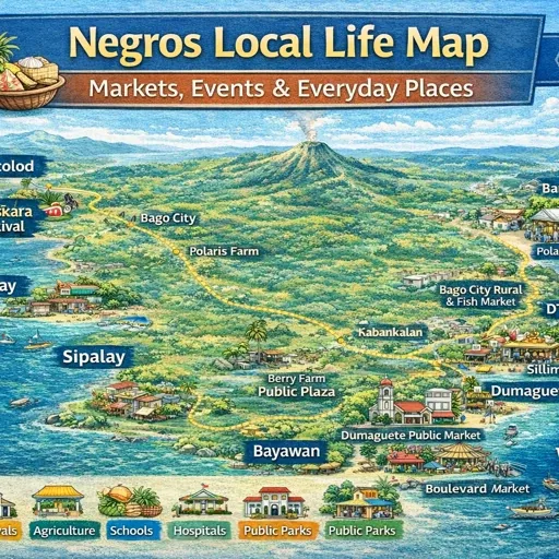
Negros Island Local Life Map – How the Island Actually Moves
Daily life on Negros Island does not follow a single pattern.
It shifts depending on where you are — coastal or inland, sugar belt or fishing village, mountain town or university city — and it shifts again depending on the time of day and the day of the week.
What stays consistent is the structure underneath. Across the island, the same rhythms organise how people move, trade, gather, and rest: market days pull people into town centres, plaza evenings draw them back out, fishing departures happen before light, drying zones appear along coastlines after the boats return, sugar trucks run their routes through harvest season, highland farmers move produce down to lowland markets in the morning, and barangay fiestas stop everything for days at a time.
This map plots those rhythms across both provinces and the island’s interior. Not attractions. Not services. The patterns of daily life as they actually operate across Negros Island.
How the Map Is Organised
The map covers municipalities across four corridors — the East Coast Slow Corridor, the North Plains and Sugar Heartland, the South Uplands and Coastal Loop, and the West Coast Slow Frontier — with the central interior now added across both provinces.
The rhythm types mapped are:
Market day and market rhythm — the days and zones where trade concentrates, whether a large public market or an early-morning barangay gathering. Market days are the clearest signal of how a town orients itself.
Night plaza — the evening gathering pattern around the town plaza, with food stalls, families, and movement. This is present in almost every municipality on the island and is one of the most consistent elements of local life regardless of province, size, or location.
Drying zones — coastal areas where fish, seaweed, or copra are spread out to dry after the morning catch. These are active for a few hours and then clear. The location is consistent — the same stretch of coast or road shoulder used daily.
Fishing rhythm — departure and return patterns along the coast. Most fishing on Negros happens from small outrigger boats launched from beach access points in coastal barangays. Departures are before sunrise. Returns are mid-morning.
Fishing work — net repair, boat maintenance, and shoreline work that happens after the boats come in. Common in Sibulan and Zamboanguita, where nets are spread on the road shoulder or beach edge in the afternoon.
Sugar work — the movement of sugarcane hauling trucks, loading zones, and mill-adjacent activity that defines the North Plains and parts of the west coast through the harvest months from roughly November to May. The Victorias Milling Company area and the corridor between EB Magalona, Manapla, La Carlota, and San Carlos show this most clearly.
Evening life — the small food clusters and roadside activity that appear in the early evening, distinct from the organised plaza gathering. These are informal — a few stalls, a bench, the front of a sari-sari store.
River life — the use of riverbanks for washing, gathering, and daily movement. Present along rivers in Kabankalan, Ilog, Bayawan, Basay, Hinoba-an, Sibulan, Valencia, Mabinay, Tayasan, and Jimalalud. The pattern is consistent: morning washing, afternoon gathering.
School rhythm — the movement around schools at the start and end of the school day. In smaller towns this is one of the most visible daily pulses — tricycles, parents, children, vendors — appearing and then clearing quickly.
Rural movement — the daily flow of produce and people between upland farming barangays and lowland market towns. Most visible in Don Salvador Benedicto, where vegetable harvests move down the mountain road each morning toward Bacolod and the sugar plains below.
Village life — the rhythm of fishing and farming barangays away from the town centres. Drying, mending, gathering, and movement that happens at the barangay level rather than the municipal level.
Barangay life — the quieter inland rhythm of foothill and upland barangays where daily movement is shaped by terrain, distance, and agricultural patterns rather than transport frequency.
Fiesta zones and fiesta routes — the geographic area a barangay or municipal fiesta occupies, and the procession route it follows. Every municipality on the island has multiple fiestas across the year. These are not background events — they restructure movement, close roads, and reorient daily life for their duration.
Basketball nights — evening barangay basketball draws a crowd in a way that is specific to certain places. Mapped in Dauin, Dumaguete, and Zamboanguita, though the pattern is widespread across the island.
Sunday quiet — areas where movement noticeably reduces on Sundays. Mapped in Dumaguete, Valencia, and Zamboanguita. Sunday in smaller towns is genuinely different in character to weekdays.
University rhythm — Dumaguete’s daily pattern is shaped significantly by Silliman University and two other universities within the city. Student movement, boarding house concentration, and food vendor clusters operate on a schedule that differs from market towns.
Sari-sari clusters — the afternoon concentration of activity around groups of sari-sari stores in barangays where there is no dedicated market. Present in Bacong and Siaton — the store front becomes the gathering point in the late afternoon.
Heritage life — Silay is the only municipality where a heritage type is mapped. The ancestral street rhythm there is distinct — morning walkers, heritage house facades, a pace that is slower than Bacolod’s urban core even though Silay is only 14 kilometres north.
Walk rhythm — mapped in Dumaguete along the boulevard and in Sipalay along the coast road. Both have an established daily walking pattern, morning and evening, that is local in character rather than exercise-focused.
The East Coast Slow Corridor
The east coast runs from Guihulngan south through Sibulan, Dumaguete, Bacong, Dauin, Zamboanguita, and into Valencia inland. It is the most varied corridor in terms of daily life patterns, anchored by Dumaguete at its centre.
Dumaguete is the only city on the east coast. Its market day runs Friday and Sunday. The boulevard walk happens every morning — a daily procession of walkers, vendors, and people at the water’s edge that starts before 6am and thins out by mid-morning. The university rhythm adds another layer: the area around Silliman University moves differently from the rest of the city, with vendor clusters around the gates, boarding houses filling the surrounding streets, and a student-driven evening food pattern along the adjacent roads. On Sundays, Dumaguete becomes noticeably quieter — the market is still active but transport volume drops and the commercial streets slow.
North of Dumaguete, Sibulan operates as a satellite rather than an independent town. Fishermen repair nets in the afternoon along the shoreline at consistent spots used most days. The riverbank serves as a washing and gathering point through the morning.
South of Dumaguete, the coast through Bacong, Dauin, and Zamboanguita is fishing-coast in character. Drying zones appear along the coastal road — Dauin’s coastal drying belt, Zamboanguita’s curve — where fish are laid out on mats or racks for a few hours before midday. In Zamboanguita, net repair happens in the afternoon at a specific spot used consistently by local fishermen. Sunday quiet there is more complete than in Dumaguete — a smaller municipality where Sunday reduces movement more fully.
Valencia sits inland from Dumaguete, upland rather than coastal. Its Saturday market day, riverbank gathering zone, school movement, and plaza evening all operate without the fishing and drying overlay present in coastal towns.
Guihulngan at the northern end of the corridor has its own morning market rhythm and coastal drying zone but operates more independently from Dumaguete than the southern municipalities.
The interior additions — Tayasan, Jimalalud, Mabinay — sit further inland from the east coast, connected to the corridor through mountain roads rather than the coastal highway. These are quieter municipalities where daily life is shaped more by terrain and distance than by traffic or trade volume. Riverbank life is prominent in all three. Market days draw in upland barangays that have limited movement on non-market days. School rhythm is one of the clearest daily pulses in each town. Mabinay sits at the edge of the karst uplands — a landscape that shapes how barangays are distributed and how movement works across the municipality.
The North Plains and Sugar Heartland
The north corridor covers Bacolod, Talisay, Silay, and the coastal municipalities running north — EB Magalona, Manapla, Victorias, Cadiz, Escalante, and San Carlos — together with the inland sugar towns and the mountain zone.
Bacolod is the largest city on the island. Its central market rhythm is one of the densest daily patterns anywhere on Negros — the market area and surrounding streets are active from before dawn, with peak movement between 5am and 9am. The lagoon area on the waterfront has an evening gathering pattern distinct from the plaza. The coastal drying strip along the inner shoreline is active in the mornings, informal in the way it uses the road edges.
Sugar work defines the corridor from Talisay north. The EB Magalona–Victorias hauling corridor, Manapla and Cadiz loading zones, Silay’s sugar belt movement — all active through harvest season from roughly November to May. The mills — Victorias most visibly — structure local life in the surrounding barangays around their operational schedule.
Silay has a different daily texture from the rest of the corridor. The ancestral street rhythm is real — the heritage houses create a specific quality of morning and evening movement, and the plaza life has a character that reflects the smaller scale of the town despite its proximity to Bacolod.
San Carlos at the north is a port town as much as a sugar town. The cross-island road to Guihulngan begins here, and transit movement through the town reflects that function.
The interior additions — Murcia, La Carlota, La Castellana — sit between Bacolod and the mountain zone. All three are sugar belt towns where the daily rhythm through harvest is structured around hauling, loading, and mill schedules. Murcia sits at the foothill edge, where the sugar plains begin to give way to the Kanlaon foothills. La Carlota has its own sugar mill and the daily movement around it — shift changes, loading zones, truck traffic — is distinct from the purely agricultural hauling pattern of smaller municipalities. La Castellana sits further south along the interior, with foothill barangays as well as plains barangays drawing into its market day.
Don Salvador Benedicto is the highland exception in this corridor — a cool mountain town above the sugar belt where vegetable farming, not sugarcane, defines the agricultural rhythm. The daily pattern there is oriented around produce movement downhill rather than hauling movement along flat plains roads. Morning harvests, roadside trading, and the loading of vegetables onto transport heading toward Bacolod are the visible daily activities. The plaza evening and market day operate at a pace and scale different from the heat of the plains towns below.
Canlaon sits on the east side of the mountain zone, at the base of the active Kanlaon volcano. Its market day draws from mountain barangays on the Negros Oriental side. The town functions as a staging point for volcano trekking and sits on the cross-island road, so transit movement through it is a consistent part of the daily pattern. The evening food cluster there serves both local residents and people passing through or preparing for mountain access.
The South Uplands and Coastal Loop
The south corridor wraps around the bottom of the island — Siaton, Bayawan, Basay on the Oriental side, and Hinoba-an where the coast curves west. It is the most remote corridor on the island and the one where the gap between municipality centres and barangay life is widest.
Siaton functions as the main staging point before the south tip. Its market day, night plaza, and sari-sari afternoon cluster are all active. The coastal village life in Siaton’s barangays follows the fishing-coast pattern — drying, mending, early departures — but access roads into those barangays are narrower and the distance between coastal barangays and the town centre is longer than in the north.
Bayawan has a morning market rhythm, school movement, and riverbank life along the river that runs through the town. Bayawan–Basay functions as a shared evening rhythm zone — food and movement on the coast road between the two municipalities.
Basay at the south tip operates at a scale and pace that reflects its distance from the island’s urban centres. Its daily life is complete — fiesta zone, market day, night plaza, riverbank life, drying zone — but quieter and more self-contained than anywhere further north.
Hinoba-an on the Occidental side is the western end of this loop, where the coast curves and movement begins to join the west coast road north toward Kabankalan.
The West Coast Slow Frontier
The west coast runs from Kabankalan south through Ilog, Cauayan, Hinoba-an, Sipalay, and Binalbagan north through Bago toward Bacolod. It has the longest distances between town centres and the strongest coastal character outside the diving zones.
Kabankalan is the main town of the southern interior, with a public market, night plaza, and riverbank life all active. The Kabankalan river is used regularly — washing in the morning, gathering through the day.
Ilog runs along a river rather than the coast, and its daily life reflects that — river village rhythm, riverside washing, a market day, and a night plaza oriented toward the inland pattern rather than the fishing coast.
Sipalay has its own character — a sunset plaza rhythm rather than a generic night plaza, a coastal walking pattern along the road that fronts the coves, and a fishing coast with drying zones in the coves themselves rather than on a continuous shoreline.
Binalbagan, Bago, and Hinigaran in the northern stretch all share the same daily pattern — coastal drying, fishing rhythm, market day, evening food, night plaza — with density and volume increasing as the road approaches Bacolod.
What the Map Shows
233 rhythm points are plotted across the island. The coverage spans 36 municipalities and four corridors, with the central interior now included.
What is consistent across the island: night plaza, market day, drying zones, fiesta rhythm. These appear in every municipality regardless of size, province, or location. They are the baseline structure of local life on Negros Island.
What varies: timing, scale, and character. A market day in Bacolod operates at a different volume and over a different area than a market day in Jimalalud. A night plaza in Dumaguete runs later and at higher density than one in Mabinay. A drying zone in Sipalay sits in a cove; one in San Carlos runs along a straight coast road. A sugar work rhythm in La Carlota involves mill-adjacent movement; the same type in Escalante is purely agricultural hauling. The type is the same. The experience is not.
What distinguishes the central interior from the coasts: the absence of fishing and drying rhythms, the prominence of river life and school rhythm, the upward orientation of movement toward highland farming in Don Salvador Benedicto, and the cross-island transit function of Canlaon. These municipalities are not peripheral — they are the zone through which the island connects east coast to west coast, and highland to lowland.