Waterfalls & Springs Map – Negros Island
How These Places Actually Work (Access + Terrain + Reality Guide)
Waterfalls and springs across Negros Island look simple on a map — scattered nature spots, often marked as individual destinations.
In reality, they don’t function as isolated attractions.
They sit within terrain systems — upland roads, river valleys, volcanic slopes, barangay access paths, and local-use water sources.
This map brings together waterfalls, cold springs, and hot springs across Negros Island, not as a checklist, but as a way to understand:
- where they actually are
- how they connect to towns
- what type of access they require
- how they fit into daily local use
The goal is not to list “must-see waterfalls.”
It is to show how these places actually work.
What This Map Contains
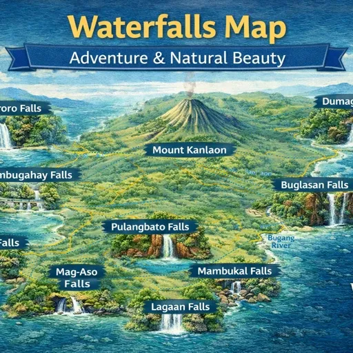
The waterfalls and springs map combines several types of natural and practical locations drawn from your GeoJSON dataset.
Depending on the layer, the map includes:
- named waterfalls (major + minor)
- natural cold springs and swimming areas
- geothermal hot springs
- river access points
- upland barangays and access roads
- trailheads and rough entry paths
- nearby villages and local anchors
- terrain transitions (lowland → upland → mountain)
Some locations are well-known.
Many are not.
Together, they form a network that shows how water features sit within the island’s geography and daily life systems.
City Core (Access Anchors, Not Cities)
Unlike city maps, waterfalls don’t have a central core.
Instead, they connect to town anchors that act as staging points.
The map shows several key jump-off areas:
- Valencia (Negros Oriental) – gateway to Pulangbato Falls and upland river systems
- Mabinay – inland cave and spring systems
- San Carlos / Canlaon foothills – access toward Mt. Kanlaon drainage areas
- Don Salvador Benedicto (DSB) – mountain ridge waterfalls and roadside falls
- Dauin uplands – smaller hidden cascades beyond the dive coast
These towns function as the real starting points, not the waterfalls themselves.
Barangay Clusters
Most waterfalls and springs are tied directly to barangays, not tourist zones.
The map reflects clusters such as:
- upland barangays around Valencia
- ridge communities in Don Salvador Benedicto
- interior barangays near Mabinay
- foothill settlements around Canlaon City
- scattered rural barangays along river systems
These are the places where:
- access roads begin
- local knowledge is needed
- permissions or guidance sometimes apply
Understanding the barangay layer is critical.
Without it, many waterfall locations appear disconnected or hard to reach.
Coastal / Rural / Upland Zones
Water features across Negros follow a clear elevation pattern.
Coastal Edge
Very few waterfalls sit directly on the coast.
Instead, coastal areas act as:
- starting points
- transport corridors
- supply zones
Examples:
- Dumaguete → Valencia access
- Bacolod → DSB mountain access
Rural Transition Zones
Moving inland, terrain begins to shift.
Here you find:
- smaller cascades
- river crossings
- cold spring swimming spots
- agricultural irrigation sources
These areas are often:
- partially developed
- locally used
- less documented
Upland & Mountain Zones
Most significant waterfalls sit in higher elevation areas.
Key regions include:
- Valencia uplands
- Mount Kanlaon foothills
- Don Salvador Benedicto ridge system
Here the map shows:
- major waterfalls
- multi-tier cascades
- geothermal hot springs
- steep terrain access routes
These zones are where water systems are strongest — but also where access becomes more variable.
Transport Corridors
Waterfalls are not randomly distributed — they follow road access patterns.
The map highlights several key corridors:
Dumaguete → Valencia Road
Access to:
- Pulangbato Falls
- Red Rock Hot Springs
- multiple smaller cascades
Bacolod → Don Salvador Benedicto
Mountain road corridor with:
- roadside waterfalls
- ridge viewpoints
- cooler climate
San Carlos → Canlaon
Foothill access toward:
- volcanic drainage systems
- upland rivers
- lesser-known falls
Interior Routes (Mabinay / Bais / Tanjay)
More remote systems including:
- caves + springs
- hidden waterfalls
- less developed access
These corridors determine what is realistically reachable in a day.
What the Map Reveals
When all waterfall and spring locations are displayed together, patterns become clear:
- Most waterfalls sit inland, not coastal
- Access depends on barangay roads, not highways
- Hot springs align with volcanic zones (Kanlaon system)
- Cold springs appear in river-fed valleys
- Larger waterfalls cluster in upland transition zones
- Many smaller waterfalls are unmarked or locally known only
Negros is not a “waterfall island” in the tourist sense.
It is an island with working water systems tied to terrain and communities.
Decision Framework
Using the map, visitors can approach waterfalls based on intent rather than guessing.
If you want:
- Easy access → roadside waterfalls (DSB corridor)
- Short trip from city → Valencia area falls
- Hot springs → volcanic zones near Kanlaon
- Hidden / less visited → interior barangay routes
- Multiple stops in one day → DSB or Valencia clusters
- More remote exploration → Mabinay / Canlaon foothills
The map helps match expectations with actual access conditions.
Slow-Pacing Reality
Waterfalls on Negros do not reward rushed travel.
Common issues include:
- underestimating travel time on mountain roads
- arriving during peak heat
- expecting developed facilities everywhere
- assuming all waterfalls are “quick stops”
Better patterns include:
- early morning inland travel
- combining 2–3 nearby locations, not 6–8
- allowing time for road conditions and navigation
- treating barangay access points as part of the experience
Many locations are not built for high-volume tourism.
They are still part of local water systems and daily use areas.
The Bigger Picture
Viewed as a whole, the waterfalls and springs of Negros form a layered system:
- Coastal towns (starting points)
- inland barangays (access layer)
- rural transition zones (small cascades + springs)
- upland systems (major waterfalls + hot springs)
- volcanic influence (Kanlaon region)
Understanding that structure changes how the island is explored.
Instead of chasing scattered pins, the map allows you to move through connected terrain systems.
This map is not about finding every waterfall.
It is about understanding where they sit — and how to reach them without friction.