Bacolod Map (City Guide + Interactive Local Map)
Barangays (334)
Bacolod has 61 barangays. The map shows boundary lines and barangay centres for all of them, from the dense inner barangays close to the waterfront grid through to the large outer residential barangays to the north, east, and south. The numbered barangays (1–41) are in the downtown core. The named barangays are the larger residential and semi-urban areas.
- Alangilan, Alijis, Banago, Bata, Cabug
- Estefania, Felisa, Granada, Handumanan
- Mandalagan, Mansilingan, Montevista
- Pahanocoy, Punta Taytay, Singcang-Airport
- Sum-ag, Taculing, Tangub, Villamonte, Vista Alegre
- Barangays 1–41 — downtown core numbered barangays
- Barangay halls: Alijis, Estefania, Granada, Punta Taytay, Taculing, Villamonte
- Handumanan Barangay DRRMO, Handumanan Barangay Health Station
- Sangguniang Barangay and Sangguniang Kabataan offices across all major barangays
Beaches & Water (172)
The water layer covers the rivers, creeks, and coastal features within and around Bacolod. Several creeks run through the barangays toward the sea, following the natural drainage from the foothills to the west coast. Water levels and flow change significantly with season — some are dry or low outside of the rainy months.
- Magsungay River — main river through central barangays
- Lupit River, Catmon River, Catalagman River, Ngalan River, Sum-ag River
- Banago Creek, Mandalagan Creek, Cabachawan Creek, Cabiguan Creek
- Hagnaya Creek, Logoy Creek, Luhod-Luhod Creek, Pahanocoy Creek
- Pantuladgon Creek, Pulo Creek, Sulom Creek, Bakyas Creek
- Sum-ag River Eco Park — riverside green area, Sum-ag barangay
- Villarosa Resort, Shelton Beach haven — coastal access points
Culture & Landmarks (136)
The culture layer combines religious buildings, heritage sites, museums, public artworks, and cultural landmarks across the city. San Sebastian Cathedral is the main Catholic anchor in the downtown core. The Negros Museum at Gaston Park is the primary civic museum. Public sculptures and MassKara-related installations appear at multiple points through the city.
- The Negros Museum — Gaston Park, downtown
- Museo de La Salle, Dizon-Ramos Museum, Vintage Glasses Museum
- Masskara Wall, Handurawan, Checkered Floor, Rizal Monument
- A Karabao and a Person, Bacolod-Murcia Milling Company Locomotive
- Pope John Paul II Tower, Saint Peter, Balay Bato, B17
- Orange Gallery, Orange Project, Studio 57, House of Frida, Peter’s Artishop
- The Jimi Hendrix Experience, Lim Guan, Mandalagan MSC
- San Sebastian Cathedral — Rizal Street, main cathedral
- Immaculate Conception Parish Church, Holy Family Parish Church
- Santo Niño Parish & Shrine, Our Lady of the Most Holy Rosary Parish — Alangilan
- Our Lady of Lourdes Parish Church, Punta Taytay Parish Church
- St. John Nepomuceno Parish, St. Jude Church, San Antonio Abad Church
- Carmelite Monastery, USLS Chapel, Sum-ag Retreat House
- Iglesia ni Cristo — locales in Handumanan, Taculing, Tomaro, Bata, Felisa, Airport Subdivision, Villa Villeta, Rojas, Jalandon, Villa Fe, Lokal ng Bacolod City
- Bacolod Central Church SDA, Bata SDA, Villa Esperanza SDA
- Fa Tzang Temple, Yong Tho Taoist Temple — Chinese community temples
- Kingdom Hall of Jehovah’s Witnesses, The Church of Jesus Christ of Latter-day Saints
- Trinity Christian Church, Calvary Temple, Bacolod Evangelical Church
Activities (1)
One activity venue is mapped in this layer.
- Negros Occidental Golf and Country Club
Cafés & Food Areas (355)
The food layer is the most extensive on the map, covering restaurants, cafes, bars, fast food, canteens, and bakeries across the city. Cansi houses are the Bacolod specialty — beef shank in sour broth, specific to Negros Occidental. Inasal and batchoy are the other local anchors. The cafe scene is dense around the commercial corridors and university areas.
- Cansi houses: Bacolod Cansi House, Bilbaos Cansi House, Sharyn’s Cansi House, Rodrigo’s Cansi House, Conee’s Cansi and Sugba
- Batchoy & noodles: Ted’s Batchoy, Super Batchoy House, Lan Ten Lomi, Chow Mi
- Inasal & chicken: Jo’s Chicken Inato, Nena’s Inasal, Tabsy Chicken Inasal, Masskara Chicken Inasal, Maskarra Chicken, Okien Pidoks Roasted Chicken
- Seafood: Scarborough Seafood Restaurant, Gina’s Seafoods Restaurant, Golden Fortune Seafoods, Preska Seafoods, Ciano’s Seafood restaurant, L’ Sea
- Fast food chains: Jollibee, McDonald’s, KFC, Chowking, Mang Inasal, Greenwich, Shakey’s, Dunkin’, Andok’s, Chooks-to-Go
- Established restaurants: Vikings, Lord Byron’s Back ribs, C’s by L’Fisher, Dalumbalay, Chateau, El Camino Uno, Byron’s, Bully’s Bistro
- Asian dining: Inaka, Kaisei, L’Kaisei, Saido Japanese Restaurant, Shabu Niku, Nezu, Fat Choi, Golden Lion, Korean Grill, CHI CHA BOX, Taberu
- Local eateries: Orange Karinderia, Diotay’s Eatery, City Lunch, Nestor Eatery, mary ann’s eatery, Imays, Saning’s, Ting Ting’s, Tita Ping’s
- Lechon: Tito Fritz Lechon, Oski and Pidok’s
- Food parks & courts: 888 Premium Mall Food Park, Terra Plaza Foodcourt, SM Fastfood, Market Place Bacolod, Merkado
- Specialty cafes: Calea, Enrico’s, Café Bobs, Kuppa, Mangkas Coffee Roasters, Coffee Culture Roastery, Native Coffee, 48° Coffee
- Chain cafes: Starbucks (two locations), The Coffee Bean & Tea Leaf, Tom n Toms, Pickup Coffee
- Independent cafes: Kabbara Café, Kafeka, Miren, Marka, KapeBro, Wayside Coffee, Lazy Hound, MudMonkey Cafè, Gutterground, GL Cafe
- Milk tea & drinks: Got Tea?, Yu Chin Shin Milktea Shop, bon appeTEA, Share Tea, Scoopy
- Bars & nightlife: MO2, MO2 Downtown, MO2 Ice, Botella Bar, Dirty South, G-Avenue Bar and Grill, Portico, Offshore, Victor’s Pub, PUBLIQ coffee & beer
- Bakeries: Merzci, Bongbong’s, Pan de Manila, Tinapay Express, Bugong Pandesal, Sofia bread & pastry, Villa Venetta Bakeshop
- Vegetarian: Vedge Health Hub, VeggieBites, Veggielicious, Sian Tian Health Food Center
Local Life (94)
The local life layer covers the civic and community infrastructure that marks the daily rhythm of barangay and city life — libraries, gyms, parks, community spaces, and places that are part of how residents move through the week rather than where visitors typically go.
- Bacolod City Public Library, DLNHS Library, NOHS Library, Fray Luis de Leon Library
- Granada Gym, Negros Occidental Golf and Country Club
- Old City Hall Fountain Area — civic gathering point, downtown
- May’s Garden — local garden space
- Fish Farm — working fish farm within city boundaries
Markets & Shopping (204)
Public markets are distributed across the barangays. The central Bacolod Public Market near the waterfront is most active before 8am. Satellite markets and talipapas serve the residential barangays. Supermarket chains cover the main commercial corridors. Local chains — Lopue’s, Merzci, Bongbong’s — are the dominant non-mall retail operators.
- Public markets: Bacolod Public Market, Bacolod City North Public Market, Libertad Public Market, Villamonte Public Market, Handumanan Public Market, Sum-ag Public Market, Monteista Public Market, Granada Market, Tangub Talipapa, Satellite Market
- Specialty markets: Negros Farmers’ Weekend Market, Organic Village, Lechonan Country, 888 ChinaTown, 888 ChinaTown Premier
- Supermarkets: SM Supermarket, SM Savemore, Robinsons Supermarket, Puregold, Gaisano Supermarket, Metro Supermarket, SaveMore, K-Mart
- Department stores: Lopue’s, Lopue’s San Sebastian, Lopue’s Panaad, Robinson’s Department Store
- Convenience chains: 7-Eleven (multiple), Shell Select, Star Mart, Amar, iMart, Munsterific
- Neighbourhood stores: Dayen’s Store, Banga Handumanan, Bangga Store, Balay ni Inday, Nita’s Store, Vergara store, Mel Sari Store
- Speciality shops: Odaegam Korean Mart, Hua Kong, China Mart, Era Mall, Funhan Mart, Indian Emporium
- Hardware & automotive: Bacolod Plastic House, Standard Electrical Shop, Kapitan Parts, Mirasol Tire Shop, NDC Tire Shop, Good Year
- Bikes & cycle: Libertad Cycle Center, Lucky bike shop, JMB Cycle Parts, Standard Bike Shop, Yael Bike Shop, Bicycle Ukay-Ukay
- Laundry: Chillax Laundry, CPAC Laundry, Lola Lavandera, Bar Rocks Laundry Services, Perl Starwash, Mr.Adam’s Laundromat
Nature & Waterfalls (37)
The nature layer covers parks, open green spaces, eco areas, and leisure grounds within and on the edges of Bacolod. Most are urban parks rather than natural landscapes — the city sits on a coastal plain and the foothills begin outside the city boundary. Bantug Lake Ranch is the main nature destination within reach.
- Capitol Park and Lagoon — main civic park, downtown Bacolod
- Panaad Park and Stadium — large sports and events ground
- Rizal Park — downtown public square
- Bantug Lake Ranch — lake and nature area, outside city centre
- Pahanocoy Eco Adventure Park — eco leisure area
- Sum-ag River Eco Park — riverside park, southern barangay
- USLS ECOPARK — university grounds green space
- UNO-R Park, Hi Strip Park, Yulo’s Park — neighbourhood parks
- Old City Hall Fountain Area — heritage civic space
- Celine Homes Playground, Lilgonville Playground — residential playgrounds
- Forest Park Resort — resort with green space
- May’s Garden — community garden
Stay Local (115)
Over 96 named accommodation options are mapped across Bacolod. Pension houses and budget inns dominate the downtown area along and near Lacson Street. Larger hotels sit on the reclamation zone and the main commercial corridors. The map shows the full spread across barangays including options well outside the city centre.
- Major hotels: L’Fisher Hotel, Seda Capitol Central, Park Inn by Radisson, Grand Regal Hotel, Grand Xing Ping Hotel
- Mid-range hotels: MO2 Westown Hotel, GO Hotels Bacolod, GT Hotel, Roost Hotel, Circle Inn, Acacia Hotel, Citadines Bacolod City, Sea Breeze Hotel, Sugarland Hotel
- Smaller hotels: East View Hotel, Business Inn, Sixty Fifth Hotel, Sweet City Captel, Bell hotel, Kings Inn, Kundutel, Planta
- Resorts: Palmas Del Mar, The Park Piazza, Boro Boro Spring Resort, Forest Park Resort, Villarosa Resort
- Heritage area: 11th Street Pension House, 11th Street Bed & Breakfast
- Pension houses: Bacolod Pension House, Bacolod Plaza Pension, Pleasant Travelers Pension House, Mainstreet Pension House, Ong Bun Pension House, Nirvana Pension House, Tindalo Pension, CGC Pension, O-Mar Pension, Belle’s Pension House, Hecita’s Pension House
- Inns & lodges: Middletown Inn, Metro Inn, MLQ Tourist Inn, O Hotel, Northwest Inn, Mahogany Tourist Inn, Roli’s Hostelry
- Apartments & residences: Taculing Court Apartelle, Alojado Dormitory, Alojado apartments, Boink’s Apartment, The Suites, Negros Residences, Aspenn Residences
- Guesthouses: Sanctuary Guest House, Greenhouse, Sanctuary Guest House, Balay ni Pines
Services (294)
The services layer covers healthcare, banking, education, government, courier, and everyday services across the city. Bacolod is the main healthcare and education centre for Negros Occidental. All major Philippine banks have branches here. The layer also includes the courier and logistics operators that handle parcel movement across the island.
- Hospitals: Corazon Locsin Montelibano Memorial Regional Hospital, Bacolod Queen of Mercy Hospital, Doctor’s Hospital, Dr. Pablo O. Torre Memorial Hospital, Metro Bacolod Hospital, Riverside Medical Center, Adventist Medical Center, South Bacolod General Hospital, Allied Care Experts Medical Center
- Clinics & diagnostic: GAC Dental Portal, Anglo Eye Center, M3 Dialysis Center (two branches), Katalbas Dental Clinic, Bacolod Social Hygiene Clinic, Una Konsulta, Medical Plaza
- Pharmacies: Mercury Drug, Southstar Drug, Watsons, TGP, Negros Grace Pharmacy, Grace Pharmacy, Sincere Drug, JDN Pharmacy, La Botica
- Banks: BDO, BPI, Metrobank, Landbank, PNB, RCBC, Security Bank, UnionBank, EastWest Bank, China Bank, Maybank, Citibank, Asia United Bank, Bank of Commerce, Philtrust Bank, UCPB, Isla Bank, Queenbank, Citysavings, Veterans Bank, NWTF/Dungganon Bank
- Universities & colleges: University of St. La Salle (USLS), University of Negros Occidental Recoletos (UNO-R), West Negros University, STI West Negros University, Bacolod City College, Carlos Hilado Memorial State University (Alijis and Fortune Towne), La Consolacion College, Riverside College, National University, John B. Lacson Colleges Foundation, AMA Computer College
- Government: New Bacolod City Hall, Bacolod City Post Office, Libertad Post Office
- Courier: LBC, JRS Express, DHL, AP Cargo, Fastcargo, 2GO
- Blood bank & health: Negros First Provincial Blood Bank, Villanueva Clinical Laboratory
Transport (538)
The transport layer is the most feature-rich on the map, covering terminals, fuel stations, ports, jeepney stops, and logistics infrastructure across the city. Two Ceres terminals handle long-distance buses. The Bacolod Port and Banago Sea Port handle inter-island ferry traffic. Fuel stations from all major brands are mapped across all corridors.
- Bus terminals: Bacolod North Ceres Terminal, Bacolod North Bound Terminal — north to Silay, Cadiz, Sagay; Bacolod Public South Terminal, Bacolod South Bus Terminal, South Ceres Bus Terminal — south to Talisay, Kabankalan, Sipalay
- Jeepney terminals: Talisay Jeepney Terminal, Silay Jeepney Terminal, Sibulan Jeepney Terminal, Malaunay Jeep station, Jeepney Terminal
- Ports: Bacolod Port, Banago Sea Port — inter-island ferry connections
- Courier & cargo: 2GO, LBC, AP Cargo, Fastcargo — at terminal and logistics hub locations
- Fuel — major brands: Petron (most locations), Shell, Caltex, Caltex Landers Bacolod, Phoenix, Seaoil, Total, Flying V, Jetti, Filoil
- Fuel — independent: 51 Fuel, Eco Oil, EcoOil, Gas & Go, SafeFuel, Star Oil, Orient Fuel, Morning Star Gas Station, 2Bil Gas Station, Mr. Fuel, Grenergy Gas, IMO Gas Station, Triple Y Gas Station, VAP Gas, RM Petrol, Rigpoint
Warnings & Seasonal Risks (34)
This layer marks areas and conditions that affect access and movement at certain times of year. Bacolod sits on a coastal plain with several creek and river systems that are subject to flooding during heavy rainfall, particularly during the southwest monsoon season from June to October. Some roads and barangay access routes become impassable during peak rain events.
The warning zones are shown as areas on the map rather than named points. Check this layer before moving through low-lying barangays after sustained heavy rain, particularly around the creek corridors in Handumanan, Sum-ag, Banago, and Tangub.
Bacolod Map
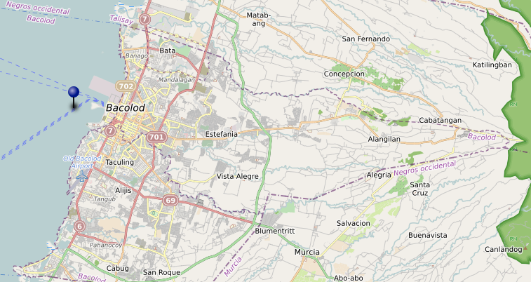
Bacolod is the provincial capital of Negros Occidental and the largest city on the island. It sits on the northwest coast, roughly halfway between the airport corridor at Silay and the sugar lands that begin just south of Talisay. Most of what happens on the western side of Negros passes through Bacolod at some point — buses, freight, people moving between towns, goods from the south reaching the main port.
The city itself is not difficult to navigate, but it takes some time to understand how it is organised. The official city area extends well beyond what most people think of as Bacolod. There are 61 barangays, and the difference between the downtown core, the commercial strips, the residential clusters, and the barangays that function almost as separate towns is significant.
What the Map Covers
The Bacolod map documents how the city actually functions across six main areas.
Public markets and local trading areas — the central public market operates near the downtown waterfront. Satellite trading activity clusters around specific barangay centres further out, particularly in the northern and southern residential areas. The map shows where these are, not just the main market.
Barangay centres and neighbourhood clusters — Bacolod’s barangays vary significantly in character. Some are dense urban barangays within walking distance of the city centre. Others are large residential areas — Cabug, Taculing, Estefania — that have their own internal logic and are effectively navigated as separate zones. The boundary lines in the map data come from OSM administrative records at admin level 10.
Transport terminals and main road corridors — the Ceres north and south terminals are the main reference points for movement out of the city. The north terminal handles Silay, Cadiz, and points north. The south terminal covers Talisay, Bago, La Carlota, and the entire coastal highway south. Within the city, jeepneys and multicabs run fixed routes that are not always obvious to newcomers. The map marks the main corridors.
Heritage grid and ancestral district — the older part of the city, roughly bounded by the streets running parallel to the waterfront, retains a grid layout from the Spanish period. Several ancestral houses remain on these streets, most of them privately owned and not open to visitors. The heritage zone is navigable on foot.
Local food areas and everyday services — karinderya clusters shift by time of day. Morning food concentrates near the market and the terminal areas. Lunch service extends into the commercial strips along Lacson Street and its side streets. The map marks the zones where cooked food is consistently available rather than listing individual establishments.
How the City Is Laid Out
The waterfront runs along the western edge of the city. The reclamation area and the SM complex sit here, along with the seaport. From the waterfront, the city spreads east — the downtown core first, then the commercial strip along Lacson Street running roughly north-south, then the residential barangays extending further east and into the flatlands toward the foothills.
The main road south out of the city is the coastal highway, which passes through Talisay before continuing down the western coast. The road north goes through the airport zone and into Silay. There is no direct cross-island road from Bacolod — the mountain crossing goes from Silay toward Canlaon, not from Bacolod itself.
The airport is not in Bacolod. Bacolod-Silay International Airport is in Silay, approximately 15 kilometres north of the city centre. Taxis and vans cover the route. This matters for timing — arriving at the airport and needing to reach the south terminal for an onward bus is a two-stage trip that takes longer than the map distance suggests.
Movement Inside the City
Jeepney and multicab routes within Bacolod are the main way most people move. The routes run between the terminals and the residential barangays, covering the main corridors. Tricycles operate within barangay zones and for shorter connections between jeepney routes.
The city is flat. Cycling is practical in some areas, though traffic on the main commercial streets — Lacson, Araneta, B.S. Aquino Drive — runs dense during morning and afternoon peak hours.
Parking is available throughout the commercial areas but fills quickly near the market and along the main shopping strips on weekday mornings and weekend afternoons.
How It Actually Works
Bacolod functions on a schedule that is not always visible to newcomers. The public market is most active before 8am. The karinderya zones are operational from early morning through early afternoon, with most cooked food gone by 1pm. The commercial strips along Lacson are active through the day but slow significantly after 9pm outside of the mall areas.
The south terminal is busy from early morning. If you are catching a bus south — to Kabankalan, Sipalay, or further — early departure avoids both terminal congestion and midday heat on what can be a long ride.
The heritage area is easiest on foot in the early morning before the streets fill. Most of the ancestral houses visible from the street are residential. A few function as bed-and-breakfast accommodation or events venues.
The barangays east of the commercial core — Cabug, Taculing, Estefania — are primarily residential and have their own markets, food areas, and service clusters. These are documented in the map but are less visited than the downtown area. They are where most of the city’s non-transient population actually lives and shops.
Related Guides
- The Insider’s Slow Map of Negros — the full map series index covering all place and thematic maps across the island
- Silay Map — the town north of Bacolod, where the airport is
- Negros Transport Map — routes, terminals, and connections across Negros Island
- Getting Around Negros Island the Slow Way — how transport works across the island, including from Bacolod south
- Zenodo dataset