
Negros Scenic Drives Map (Slow Loops + Viewpoints)
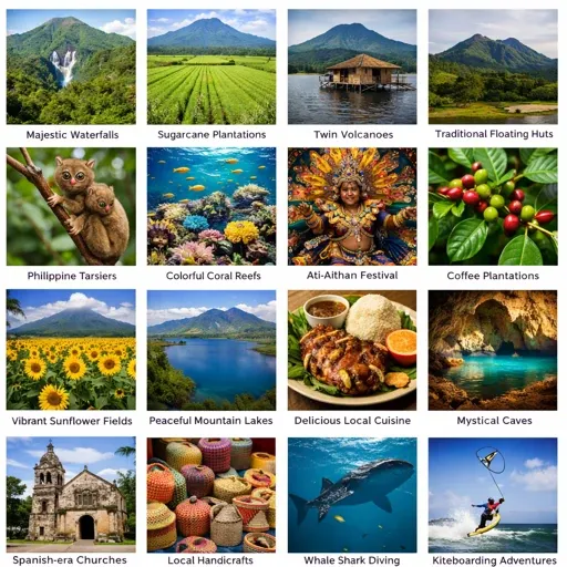
Negros Occidental Eco-Tourism Highway
The Negros Occidental Eco-Tourism Highway runs through the highland interior of Negros Occidental, connecting municipalities from the north of the island through Don Salvador Benedicto and into the upland zones. It is the formal designation for the mountain road corridor that passes through coffee-producing barangays, highland farms, and forested ridgelines. The highway links the lowland Bacolod corridor to the upland municipalities and provides access to the island’s interior natural areas.
- Route corridor: Don Salvador Benedicto — Murcia — Bacolod; the highland section of the Bacolod–Don Salvador Benedicto drive follows this highway
- Elevation and vegetation: the highway passes through the transition zone from lowland sugar agriculture into highland forest and coffee country
- Key stops along the highway: Mambukal Resort junction, Punan Bridge crossing, Kambang Bat Farm turnoff, Kubo ni Maria, DSB view deck and lion landmark
- Coffee and produce: Don Salvador Benedicto is the main coffee-producing municipality on the western side of the island; roadside stalls along the highway sell highland produce and coffee
- Seasonal conditions: fog is common on the upper ridge sections in early morning and during the southwest monsoon; road surface is generally paved but conditions deteriorate after heavy rain on steeper sections
Transport – Route Start Points (3)
The three mapped scenic drives each have a named start point on the map. All depart from the main city or town centre before moving into the route proper.
- Bacolod City Start Point — urban start before the climb inland through Murcia toward Don Salvador Benedicto
- Dumaguete Start Point — city-side starting point before the ascent toward Valencia
- Murcia Town Proper — transition point from the Bacolod lowland edge into the agricultural upland road
Local Life – Town Anchors (3)
The main civic and community anchors along the three drives — the points where each route passes through a functioning town centre rather than open road.
- Sugarcane Edge Section — lowland agricultural stretch where the Bacolod road begins leaving the coastal plain and entering the sugar belt
- Don Salvador Benedicto Town Center — main municipal anchor in the cooler upland section of the Bacolod–Don Salvador drive; the furthest point of the highland climb before descent
- Valencia Municipal Hall — main town anchor in Valencia and natural midpoint on the Dumaguete–Valencia–Casaroro drive
Cafés & Food Areas (2) + Food Areas (1)
Named food stops along the drive routes — roadside eateries, produce stalls, and town-centre food areas that are part of movement through the route rather than standalone destinations.
- Murcia Eatery Strip — simple local eateries in Murcia town before the mountain climb begins on the Bacolod–Don Salvador drive
- Roadside Fruit Stall Area — typical roadside produce and snack stop along the highland climb section
- Valencia Town Food Stop — town-centre food area in Valencia before continuing into the cooler uplands toward Casaroro and Pulangbato
Markets & Shopping (1)
One market is mapped along the scenic drives — in Murcia, on the Bacolod–Don Salvador route. It shows how food and supplies move inland through the town before the road climbs into the upland zone.
- Murcia Public Market — everyday wet market in Murcia town, showing the agricultural supply system at the lowland-to-highland transition point
Activities (2)
Activity points along the drives — places where the route changes character or where a stop makes sense beyond eating or accommodation.
- First Upland Climb — the early section of the Bacolod–Don Salvador drive where the road begins to open into elevated views and the sugar plain drops away
- Tejero Highland Resort — one of the nearest upland stops from Valencia town proper on the Dumaguete–Valencia route
Stay Local (2)
Accommodation options along the drive routes — for those using the scenic drives as overnight journeys rather than day trips.
- Forest Camp Area — known mountain resort area in the Valencia uplands, on the Dumaguete–Valencia–Casaroro route
- Mountain Stay Area — general area for simple ridge stays and mountain resorts along the Don Salvador Benedicto highland drive
Nature & Waterfalls – Don Salvador Route (4)
Natural features along the Bacolod–Murcia–Don Salvador Benedicto highland drive. The upland ridge section has open mountain views and the Malatan-og Falls area is the main waterfall stop.
- Highland Ridge Pull-Off — simple roadside pull-off with wider mountain views across the upland zone
- Jomax’s Peak Area — popular ridge stop with open views over the highlands; a natural pause point on the drive
- Malatan-og Falls — named waterfall stop in the Don Salvador Benedicto uplands; one of the best-known waterfall landscapes in the area
- Malatan-og Viewing Deck — roadside viewing point overlooking the Malatan-og Falls landscape
Nature and Waterfalls – Valencia Route (2)
Natural features along the Dumaguete–Valencia–Casaroro route. The Valencia uplands have multiple waterfall and viewpoint options spread across the approach road from the town.
- Casaroro Falls — one of the main destinations on the Valencia upland drive; steep trail descent from the access road above Valencia town
- Valencia Upland View Area — general cooler-upland viewpoint between Valencia town and the waterfall and hot spring zone
Warnings & Seasonal Risks – Don Salvador Route (2)
Two risk zones marked on the Bacolod–Don Salvador highland drive. Both are related to upland road conditions that change significantly in wet weather.
- Fog-Prone Ridge Section — upland ridge section where visibility can drop sharply in wet weather and on early mornings; most common during the southwest monsoon season
- Mountain Curve Section — curving road section where mountain driving becomes more demanding; requires care in wet conditions and with oncoming vehicles on narrow sections
Warnings and Seasonal Risks – Valencia Route (1)
One risk zone on the Dumaguete–Valencia–Casaroro route.
- Casaroro Access Area — road and stair access to Casaroro Falls; the descent is steep and the stairs become slippery after rain; not advisable in wet season without dry-weather preparation
Silay Heritage & Upland Route
The Silay route covers the heritage district in the town centre, the coastal barangays to the north, and extends into the upland barangays toward the Northern Negros Natural Park. This is the most feature-dense route on the map with 98 named points covering heritage houses, cafes, accommodation, services, and natural sites.
- Heritage: Balay Negrense Museum, Don Bernardino Jalandoni Museum, German Locsin Unson House, Hda. Cilisap 1, Old Silay Wharf, San Rafael, Bangga Tagay, Cato village, Heritage House, Jct. Benita Jarra–Guimbala-on access road
- Food: El Ideal, Cafe 1925, Café Katartizo, Cafe Velo, Duyan Cafe, Pantaw Cafe, Rooster Cafe, Sky Go Cafe & Resto, Hestia’s, Cocina de Barrio, Chicken House, Edgewater Native Restaurant, Fishers Pond Seafood and Grill, Melkens Seafood Restaurant, Seaside Floating Restaurant, Golden Food Park, M/V Felicious Cafe, SIR, Balay Kapehan
- Nature: Balaring Mangrove Eco-tourism Park, Balaring Mangrove Tower, Diwal Platform, Vantage, Viewpoint, Cacao Top, Pine Tree Peak, Lantawan Trail Entrance, Camp Site
- Stay: German Unson Heritage House Bed & Breakfast, GK Hacienda Paz, GK Fiat Silay, Pegasus Pension, Richmond Inn, Baldevia Pension House, Hawaiian, Sion residence, Guest House
- Services: Silay City Hall, Silay Public Market, Silay City Tourism Office, BPI, Caltex, Rizal Street Fuel Stop, Silay Police Station, San Diego Pro-Cathedral, Virgen Sang Barangay National Shrine, Lokal ng Silay, Domus Dei, Lantawan Water Reservoir
Dumaguete – Valencia – Casaroro – Pulangbato – Twin Lakes
Three mapped route lines from Dumaguete into the Valencia uplands — to Casaroro Falls, to Red Rock and Pulangbato, and to Twin Lakes. All three begin at the Dumaguete Start Point and pass through Valencia Municipal Hall before diverging into the upland barangay roads.
- Dumaguete – Valencia – Casaroro Falls — the main upland route; passes Valencia town, Forest Camp Resort, Tejero Highland Resort; destination is Casaroro Falls with the Casaroro Access Area as the approach marker
- Dumaguete – Red Rock – Pulangbato — route to Red Rock Hot Springs and Pulangbato Falls; branches from the Valencia road into the Pulangbato barangay area
- Dumaguete – Twin Lakes — route to Balinsasayao Twin Lakes National Park and Information Center; longer drive into the interior
- Additional stops: Valencia Town Food Stop, Valencia Upland View Area, Little falls, Kansalakan Enchanted River, Lake Balanan
Negros Island Scenic Drives – How the Routes Actually Work
Negros Island has two distinct geographies running parallel to each other: a highland spine that divides the island north to south, and coastlines on each side that behave differently in terms of road quality, settlement patterns, and what the drive actually involves. Understanding which type of route you are on changes what you will encounter and how long it will take.
The drives below are organised by how they function — mountain ascents, coastal corridors, and inland routes into the island’s interior — rather than by distance or difficulty.
Mountain and Highland Drives
These routes all involve leaving a lowland city or town and climbing. Road conditions change once the elevation increases. The air temperature drops noticeably. Vegetation shifts from sugar fields and coconut to forested ridgeline. These drives reward patience rather than speed.
Negros Occidental Eco-Tourism Highway
The Eco-Tourism Highway is the formal designation for the highland road corridor running through the interior of Negros Occidental — from the lowland edge of Bacolod through Murcia and up into Don Salvador Benedicto. It is the route the Bacolod–Don Salvador Benedicto drive follows in its upper section.
The highway passes through the coffee-producing zone of DSB, forested ridgelines, and the upland barangays that supply produce to the city markets below. The Mambukal Resort junction, Punan Bridge, and Kambang Bat Farm turnoff are the main reference points along the corridor. Road surface is generally paved but the upper ridge sections are affected by fog in early mornings and deteriorate after heavy rain.
Bacolod – Don Salvador Benedicto Mountain Drive
This is the most established highland drive on the island’s western side. The route leaves Bacolod city through Murcia, passes the Mambukal junction, crosses Punan Bridge, and climbs steadily through mountain road with open views toward Mount Canlaon before reaching Don Salvador Benedicto. The town sits at an elevation that keeps it noticeably cooler than Bacolod, and it functions as a coffee-producing zone. The Kambang Bat Farm turnoff near Barangay Igmayaan adds a specific destination logic to the upper section of the drive. Kubo ni Maria is a regular stopping point for people who make this drive. The lion landmark and view deck near the DSB town area are reference points most locals use when describing the route.
Silay – Patag Upland Drive
This route uses Silay — a city already associated with heritage architecture on the northern Negros Occidental plain — as the starting point for a climb into the uplands north of the main highland spine. The transition from sugar plain to forest-edged road happens quickly once you leave the Silay urban area. This drive works best as a landscape route rather than a destination-dense one.
Dumaguete – Valencia Mountain Drive with Pulangbato and Casaroro
Valencia is a separate municipality directly upland from Dumaguete, and the road between them climbs fast enough that the temperature difference is perceptible within 20 minutes of leaving the city. Valencia town proper has its own local economy and market rhythm. From Valencia, the road continues toward Pulangbato Falls and the Casaroro Falls area, both of which require time and involve trail sections on foot. This drive functions as a short but steep mountain access route rather than a long scenic corridor.
Sibulan – Twin Lakes Drive
The attraction here is the gradual shift from Dumaguete-adjacent lowland through Sibulan and into the lake and forest zone. The two lakes — Balinsasayao and Danao — sit within a protected area accessed by a road that becomes a forest track in its final section. The drive itself is the experience, not the arrival. Families and local visitors use this corridor on weekends, which affects road use timing.
Dumaguete – Mabinay Interior Drive
Mabinay is known for its cave systems and sits in the island’s interior road network, accessible from both the Dumaguete side in the east and the Kabankalan–Ilog side in the west. From Dumaguete, the drive is an inland route that moves away from the coast entirely, passing through sugarcane and upland zones before entering Mabinay’s karst geography. From the western side, the approach runs through Kabankalan and Ilog before reaching Cantoni and then Mabinay — a longer cross-island interior route that functions as a genuine island-crossing rather than a day drive from a single base.
San Carlos – Canlaon Flank Route
San Carlos sits on the northern Negros Occidental coast and serves as the lowland entry point for reaching the flanks of Canlaon Volcano — the island’s most significant natural reference point. The road climbs from sea level into upland forest and agricultural zones that face the Canlaon massif. This route works as a mountain approach drive rather than a summit route, as access to the crater area requires permits and a separate process through DENR.
Coastal Drives
These routes run parallel to the sea. The east coast road in Negros Oriental is generally better-maintained and more consistently paved than many of the west coast sections. Coastal drives on Negros operate differently from mountain routes — the stops are more frequent, the visual anchor is the water on one side, and road conditions change more with weather near southern coastal zones.
Dumaguete – Dauin – Malatapay Coastal Drive
This is the clearest coastal corridor on Negros Oriental’s southern stretch. The road runs from Dumaguete city south through Bacong, Dauin, Zamboanguita, and ends practically at Malatapay wharf. Dauin is the primary dive and snorkel town on this corridor, with entry points to the marine sanctuary sitting along the road. Malatapay functions as the regular weekly market town and the departure point for boats to Apo Island. The drive is simple in logic: flat coastal road, sea on one side, barangay centres at intervals.
Bais – Tañon Strait – Manjuyod Coastal Drive
Bais City is the base for dolphin-watching boat trips into the Tañon Strait, which happens in the early morning and is tide and weather dependent. Manjuyod Sandbar, accessible by boat from the coast near Capiñahan Wharf, appears at low tide and is one of the more recognisable shallow-water landmarks in Negros Oriental. As a drive, the coastal road through this corridor passes through fishing and mangrove zones. The bird sanctuary and mangrove park are part of the same coastal system.
Kabankalan – Hinoba-an Southwest Coast
This is a longer, quieter route along the western southern coast. The road runs through zones that are less trafficked than the Dumaguete coastal corridor, and the visual character changes from sugar fields to coastal settlements as you move south toward Hinoba-an. Distance and the changing character of the coast are what define this drive — not dense stops.
Sipalay – Cauayan Coastal Drive
Sipalay sits in the southwest and the coastal road through to Cauayan covers some of the quieter beach access stretches on the island. The coast is the attraction here, not a series of towns with distinct functions. This drive suits slower movement and works better approached from Sipalay as a base.
Trips with Fixed Destinations
These are not drives in the same sense — they involve a road section followed by a boat, a trail, or a specific arrival point that is the purpose of the trip.
Malatapay – Apo Island
Boats to Apo Island leave from Malatapay Wharf, which is reached by driving south from Dumaguete along the coastal road. The island itself has no vehicles. The drive to the wharf is approximately 30–40 minutes from Dumaguete under normal road conditions. Departure time matters because crossing conditions and boat availability change through the day.
Bais – Tañon Strait Dolphin Trip
This uses Bais City as the base and involves a boat trip into the Tañon Strait rather than continued road movement. The morning timing is standard because dolphin pod presence is more consistent early. This is a fixed-destination trip attached to the Bais coastal area rather than a through-drive.
Lake Balanan – Siaton – Nadag Inland Trip
This route moves inland from the Siaton area in southern Negros Oriental into the Balanan mountain ranges. Lake Balanan is a highland lake with a different character from the Twin Lakes closer to Dumaguete — it is more remote and the approach road reflects that. Nadag sits further into the interior. This trip functions as an inland exploration of southern Negros Oriental rather than a standard scenic drive, and road conditions toward Nadag are variable.
How the Route Network Actually Functions
The mountain drives and coastal drives rarely connect to each other mid-route in a practical way. Most routes begin and end at the same lowland city — Bacolod in the west, Dumaguete in the east — because the cross-island road options are limited and the terrain between the coasts is steep.
The Mabinay cave country is one of the few interior points that genuinely serves as a connection node between east and west. The Bacolod–Kabankalan–Mabinay–Dumaguete corridor is the closest thing the island has to a central cross-island drive, and it takes a full day under normal conditions.
Timing matters differently on mountain routes versus coastal ones. Mountain drives are better in the early morning before cloud cover drops on the ridgelines. Coastal drives in the south are affected by sea conditions if the trip involves boat access. The north coastal zones are generally calmer.