
Local Stays on Negros Island — Guesthouses, Pension Houses & Where People Actually Sleep
Apartments & Long Stays (27)
Apartments and extended-stay units across both provinces — used by longer-term visitors, workers on contract, students, and people in transition. Most operate on weekly or monthly rates rather than nightly. The concentration is heaviest around Dumaguete and its immediate coastal municipalities, where the university presence and diving industry create consistent demand for longer stays.
- Bacolod: Alojado apartments, Aspenn Residences, Benjamin Hall, Macris, Santorini, White House
- Sibulan / Bacong: Carlo’s Place, Ferolin Apartment, Ferrer’s Residence, Gemini’s Apartment, Gretel’s Apartment, Hassaram Courtyard, Honey Villas, Mat’s Place, MoNaPil Cottages, San Diego Town Homes 888, Silliman University RSA Cottages, Tokofish, Upland Townhouse
- Dumaguete: Josefina Casapao, Marpas Apartments, Navarro Apartments, Pethaus
- Ilog / Cauayan: Lory Tanjusay’s Residence, Romeo Tanjusay’s Residence
- Bago / La Carlota: GardenView Apartments
- San Carlos / North: SM Cadiz
Chalets – Guesthouses (6)
Self-contained or semi-private units in resort, farm, and heritage settings — separate from standard pension house accommodation in character and setting. Most are in quieter locations outside town centres.
- San Carlos / North Negros Oriental: Balai Ramirez, Balay Gemico Asqeulon, Boss Telo
- Sibulan / Bacong: Desiderata Home
- Dumaguete: Rose Lamb Sobrepeña Writers Village
- Negros Island: Villa Angela Subdivision
Hostels – Backpackers (31)
Budget hostel and dormitory-style lodging across the island — shared facilities, lower nightly cost, used by backpackers, students, and short-stay visitors. The densest concentration is in and around Dumaguete, where the university and dive tourism create consistent demand. Bacolod has several budget options near the commercial centre.
- Bacolod: Alojado Dormitory, Cokin Building, Hecita’s Pension House, Nirvana Pension House, O-Mar Pension, Roli’s Hostelry, Sweet City Captel, The Park Piazza, Tindalo Pension
- Sibulan / Bacong: Antwet Backpackers Hostel, Crown Hostel, Dastraum Guesthaus, Daymiel’s Dormitory, Dumaguete Dormitel, Gazebo Pensione, Harold’s Mansion, Kevin and Alma Lady Bedspace, Moriah Pension Inn, Navarro’s Apartment, Negros Oriental Hotel, Seis Hostel, The Flying Fish Hostel, White Knight Dumaguete
- Dumaguete: Negros Lodging House
- Hinoba-an: Driftwood Village Resort, Eva’s Inn
- Bago / La Carlota: Des & Jun’s Corner
- Canlaon / San Carlos: Baring’s Boarding House, Dragon Inn
- Negros Island: Buenos Aires Hostel, Rooms For Man
Outdoor – Camping (14)
Campsites, farm camps, and outdoor overnight locations across Negros Island — used by hikers, trail visitors, and group camps. Facilities vary significantly: some are managed sites with basic infrastructure, others are informal spots known to locals and trail users. Most are in upland or interior barangays, away from coastal towns.
- Hinakpan mystical hills — upland barangay site, cone hills landscape
- Jamelo Farm and Camp Site — farm-based camping
- Leo Ridge — ridgeline camping
- Montefrio — upland camp location
- Nailig Campsite — named campsite
- Ranchohan — farm and camp
- Samuyao Hills — hills camping area
- Puncak Tanawan — Sibulan / Bacong upland camp
- Sheintan Ridge View — Dumaguete area ridgeline
- Forest Camp — Dumaguete area
- La Marings — San Carlos / North zone
- Mowgli’s Camping Sites Rental — San Carlos / North zone
- Tinagong Dagat Camp — San Carlos / North, inland lake area
- Viñas Farms, Inc. — Bago / La Carlota, farm camp
Lodges & Inns (14)
Local inns and lodges distributed across both provinces — short-stay accommodation used by road travellers, local visitors, and workers between towns. Most are accessed directly off main roads or in the commercial areas of their municipality.
- Bacolod: Bacolod Imperial Court, Baldevia, Buena Inn, Dragon Lodge, Eva’s Inn, Jade Court, Moonlight Lodge
- Sibulan / Bacong: Casa Luna, Golden Inn Pension House, Honeybee’s Inn, Velez Pension House, Wild Wind
- Dumaguete: Blue Dream Pension Haus
- Ilog / Cauayan: Bella’s
Pension – Guest Houses (104)
The largest layer on the map — 104 pension houses and guesthouses distributed across both provinces and most municipalities. These are the backbone of local accommodation on Negros Island: family-run operations outside the hotel sector, used by workers in transit, long-term visitors, and anyone who needs functional clean accommodation without resort pricing.
- Bacolod: 11th Street Bed & Breakfast, 11th Street Pension House, Akina Staffhouse, Bacolod Pension Plaza, Balay ni Pines, Boink’s Apartment, CHMSC Hometel, De laps residence, Dojo 8, E&M BLDG., Greenhouse, Home in CPAC, Lopez Jaena Home, MLQ Tourist Inn, Ong Bun Pension House, Pedrosa Residence, Pleasant Travelers Pension House, Sanctuary Guest House, Shelton Beach haven, The Good Shepherd Training Center
- Silay / Talisay: Baldevia Pension House, German Unson Heritage House Bed & Breakfast, Pegasus Pension
- Kabankalan / Himamaylan: cano lim pension, Ester Ken Tourist Inn, Hometown Inn, lima house
- Hinoba-an: BANGGA ANGEL VICTORIA LODGING HOUSE, C View Haven, Matlag Farm House, Perth resort, tourist lodging center, Vista Real Pension House
- Ilog / Cauayan: Ajp inn, Han’s Guest House, hans Guest House, Justine’s Guest House, Mansion nina Kuya Ryan, Trisha house
- Sipalay: Blanca Lodge
- Bago / La Carlota: J RESORT, Mystel Inn Accommodation, Pedales’s Residence
- Canlaon / San Carlos: A&C Pension Haus, Beulah-land Retreat House, Canlaon City Pension House, F &C Guesthouse, Fabricanus village, J&L Business Inn, Laguda Apartelle, Lola Nitang Pension House, Mountain Citi, Pondside Cottage Inn, SJRI Guest House, YM Business Inn
- San Carlos / North: B.C. Pension, Balay na Red, Cano Gwapo, Despi Family, Eljoy Beach Resort, Hda romana, Lot amigo, Mai2’s Place
- Sibulan / Bacong: AQ house, Ayang’s Place, Bolmon Pension, Elaine’s Abode, GAT Apartments, Gabby’s Bed & Breakfast, La Fusion guest house, Montenegro new staff house, ND Lodge, Opeñas Pension, Pamplona Guest House, Paradis Villa, RM Guest House, Sam’s Bed And Breakfast, Sola guesthouse and restaurant, Tati’s Place, Tree Hive Guest House, U Pension, Viason’s place, White Cansas, YMCA Guesthouse & Downtown Center
- Dumaguete: Argana Cottages, BROX’s, Caesar’s Place, Dauin yanson resort, FiveTans, Fmidc hub, Harold’s Eco-Lodge, Jarison Pension House, NoMa Mountain Getaway, Pyramide Guest House, Reivens Guesthouse, Rey Tan’s Bachelor’s Pad
- Dauin / Zamboanguita: Thad’s Place
- Negros Island: Guintubdan Pavilion, Hector’s Place, Kubling Kalikasan Beach Resort, LGC’s Pension House, Prescilla house, way to Tiyo Josie House
Hotels – Bacolod (unlayered)
The map also covers the mid-range and larger hotel sector in Bacolod — these appear on the map as reference points for the city’s accommodation range alongside the pension house and local stay options.
- Major hotels: L’Fisher Hotel, Seda Capitol Central, Park Inn by Radisson, Grand Regal Hotel, Grand Xing Ping Hotel
- Mid-range: MO2 Westown Hotel, GO Hotels Bacolod, GT Hotel, Roost Hotel, Circle Inn, Acacia Hotel, Citadines Bacolod City, Sea Breeze Hotel, Sugarland Hotel, Business Inn
- Smaller hotels & inns: East View Hotel, Sixty Fifth Hotel, Kings Inn, Kundutel, Planta, Bell hotel, Bascon Hotel, Check Inn, Northwest Inn, Metro Inn, Middletown Inn
- Resorts & other: Palmas Del Mar, Boro Boro Spring Resort, Forest Park Resort, Royal Am Rei Hotel, West Town Hotel
- Residences & serviced: Taculing Court Apartelle, Negrense Suite, Negros Residences, O Residence, O Hotel, The Suites, Avenue Suite, Luxur Place, 888
- Pension houses: Bacolod Pension House, Bacolod Plaza Pension, Mainstreet Pension House, CGC Pension, Belle’s Pension House, Mahogany Tourist Inn
Stay Zones & Area Guide (161)
The Stay Zones layer maps 161 geographic zones across Negros Island — not individual accommodation but the areas and corridors where staying makes practical sense based on access, character, and how the place functions. Zones are grouped by municipality and describe the terrain, pace, and context of staying in each area.
- Bacolod zones: Backroad Stay Loop, Barangay Hills Stay Zone, Coastal Plain Stay Zone, Heritage Stay Grid, Inner Coast Stay Zone, Inner Neighborhood Stay Zone, Sugar Belt Stay Edge
- Bacong zones: Barangay Stay Cluster, Coastal Barangay Stay Strip, Coastal Stay Zone, Heritage Stay Pocket, Rural Stay Loop, Upland Stay Edge
- Bago zones: Coastal Stay Edge, Highland Edge Stay Zone, Rice Plains Stay Zone, River Stay Corridor, Rural Stay Loop, Sugar Heartland Stay Zone
- Basay zones: Coastal Stay Villages, Coastal Strip Stay Zone, Forest-Edge Stay Zone, Mountain Pocket Stay Zone, Mountain-Edge Stay Zone, River Stay Corridor, Rural Plains Stay Zone
- Bayawan zones: Barangay Hills Stay Zone, Coastal Curve Stay Zone, Coastal Stay Strip, Forest-Edge Stay Zone, Inner Loop Stay Zone, River Stay Pocket, Rural Stay Loop, Upland Stay Belt
- Cauayan zones: Coastal Curve Stay, Coastal Village Stay, Forest Edge Stay, Forest Ridge Stay, Inner Village Stay, Ridge Pocket Stay, Ridge Stay Corridor, Rural Plains Stay
- Dauin zones: Coastal Stay Belt, Coastal Village Stay Zone, Foothill Stay Zone, Forest Stay Pocket, Ridge Stay Line, Village Stay Pocket
- Dumaguete zones: Backstreet Stay Zone, Barangay Hills Stay Zone, Boulevard Stay Pocket, Creative Stay Cluster, Inner Coast Stay Zone, Inner Stay Grid, Market Edge Stay Zone, Riverside Stay Edge, Stay Grid
- Hinoba-an zones: Coastal Curve Stay, East Coast Stay Zone, East Plains Stay Zone, East Ridge Stay Zone, Forest Stay Pocket, Forest-Edge Stay Zone, Inner Hills Stay, Ridge Stay Line, Ridge Village Stay, River Stay Corridor, Rural Stay Loop, Sunset Stay Belt, Upland Stay Belt, West Coast Stay, West Ridge Stay
- Ilog zones: Coastal Belt Stay, Coastal Stay Edge, Forest Edge Stay, Forest Stay Pocket, Highland Stay Pocket, Ridge Village Stay, River Plains Stay, River Village Stay, Rural Stay Loop
- Kabankalan zones: Coastal Curve Stay, Coastal Stay Belt, Forest Edge Stay, Forest Ridge Stay, Ridge Stay Corridor, Ridge Village Stay, Rural Plains Stay, Upland Stay Belt, Village Stay Cluster
- La Carlota zones: Heritage Stay Pocket, River Stay Edge, Rural Stay Loop, Sugar Plains Stay Zone, Sugar Ridge Stay Zone
- La Castellana zones: Foothill Stay Belt, Mountain Edge Stay Zone, Ridge Stay Line, Rural Plains Stay Zone, Sugar Village Stay Cluster
- Murcia zones: Foothill Stay Belt, Highland Stay Pocket, Mountain Edge Stay Zone, Ridge Stay Line, Sugar Village Stay Cluster
- Siaton zones: Barangay Stay Cluster, Coastal Stay Belt, Forest Stay Pocket, Mountain-Edge Stay Zone, River Plains Stay Zone, River Stay Corridor, Rural Plains Stay Zone, Sunset Hills Stay Zone, Upland Stay Villages
- Sibulan zones: Coastal Stay Strip, Foothill Stay Belt, Mountain Edge Stay Zone, Ridge Stay Cluster, River Stay Zone, Rural Plains Stay Zone, Rural Stay Pocket
- Silay zones: Ancestral Ridge Stay Zone, Ancestral Stay Pocket, Coastal Stay Curve, Forest Edge Stay Zone, Heritage Stay Grid, Sugar Belt Stay Zone
- Sipalay zones: Coastal Village Stay, Cove Stay Belt, Fishing Village Stay, Forest Edge Stay, Inner Hills Stay, Inner Plains Stay, Ridge Stay Corridor, Rural Plains Stay, Rural Stay Loop, Sunset Coast Stay, Sunset Hills Stay
- Talisay zones: Coastal Stay Edge, Heritage Stay Pocket, Inner Plains Stay Zone, Ridge Stay Line, River Stay Corridor, Sugar Plains Stay Zone
- Valencia zones: Barangay Stay Loop, Foothill Stay Town, Forest Edge Stay Zone, Highland Stay Pocket, Ridge Stay Corridor, River Stay Pocket, Upland Stay Belt, Waterfall Approach Stay Zone
- Zamboanguita zones: Coastal Curve Stay Zone, Coastal Stay Zone, Forest-Edge Stay Zone, Inner Village Stay Zone, Ridge Pocket Stay Zone, Ridge Stay Line, Rural Stay Loop, Upland Stay Belt
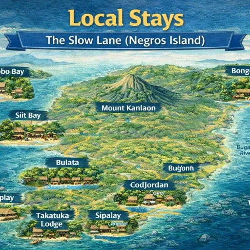
Local Stay – Negros Island
Accommodation on Negros Island outside the resort sector is not organised the way most visitors expect. There is no single zone where guesthouses and pension houses cluster, no booking platform that covers the full picture, and no consistent signage that separates a family-run pension from a budget business hotel. What exists is spread across both provinces, concentrated in the towns but also present in barangays and coastal strips where no formal accommodation sector exists on paper.
This map documents where stays are located, how they are distributed across the island, and what the character of different zones tends to be.
How the Map Is Organised
The map covers 409 features across four regions: North Plains and Sugar Heartland, West Coast Slow Frontier, East Coast Slow Corridor, and South Uplands and Coastal Loop. Within those regions, 30 areas are mapped across both Negros Occidental and Negros Oriental.
Two types of features appear on the map. The first are actual mapped places — pension houses, guesthouses, apartelles, and hotels recorded in OpenStreetMap with a confirmed location. These are concentrated in Bacolod, where the density of accommodation in the city centre and surrounding barangays is high enough to map individually. The second type are stay zones — areas documented by character and function rather than individual listing. These cover the rest of the island, where accommodation is thinner on the ground and the relevant information is about where stays tend to cluster and what the surrounding area is like, rather than which specific buildings are open.
Bacolod
Bacolod has the highest concentration of individually mapped accommodation on the island. Pension houses and small hotels sit close together in the city centre barangays — around the plaza, along the main commercial streets, and in the blocks between the market area and the boulevard. Names like Bacolod Pension House, Belle’s Pension House, Bacolod Plaza Pension, and Mainstreet Pension House indicate the character: small, functional, priced for regular use rather than tourism. Larger hotels — L’Fisher, Seda Capitol Central, Park Inn by Radisson, Acacia — occupy the same general zone but at a different scale and price point.
Away from the city centre, accommodation spreads into the surrounding barangays along different patterns. The coastal plain toward Talisay has a sugar belt character — flat agricultural land with some farm-oriented stays. The barangay hills to the east have quieter residential zones. The inner neighbourhood grid around the commercial centre holds the densest concentration of short-stay options.
North Plains and Sugar Heartland
This region covers the northern Negros Occidental corridor — Bacolod, Silay, Talisay, and the agricultural plains between them. The sugar industry shapes the land use here, which means long stretches of flat cane fields between towns with accommodation mostly located in the town centres rather than along the roads between them.
Silay has a heritage stay character — the old town centre and the surrounding sugar baron houses create a distinct zone. Talisay sits between Bacolod and Silay and functions partly as overflow from both. The stay zones here are documented as sugar plains stays and river stays, reflecting the landscape rather than a formal accommodation sector.
West Coast Slow Frontier
The west coast running south from Bacolod through Bago, La Carlota, Kabankalan, Himamaylan, Hinoba-an, Sipalay, and Cauayan is the main highway corridor of Negros Occidental. Towns along this route have accommodation in their poblacion areas — pension houses and small inns that serve the highway trade rather than destination visitors.
Sipalay is the exception. The coastline here has a different character — accommodation spread across a long stretch of coast with coves, beaches, and a mix of simple guesthouses and small resorts. Cauayan, at the southern end, extends the same pattern. The stay zones along this corridor include coastal stays, cove stays, ridge stays, and forest edge stays that reflect the terrain moving inland from the coast.
Further south, Ilog and Cauayan cover a quieter stretch where accommodation is sparse and the zone character is mostly coastal village and rural.
East Coast Slow Corridor
The eastern side runs from Sibulan and Bacong north of Dumaguete, through Dauin and Zamboanguita toward the southern tip. Dumaguete is the main accommodation hub on this side — the city has pension houses and guesthouses concentrated near the boulevard, the market, and the university area.
The towns south of Dumaguete — Bacong, Dauin, Sibulan — sit close enough to the city to function partly as residential overspill but also have their own coastal stay zones along the shoreline. Dauin in particular has accommodation associated with the dive sites along its coast and the Apo Island access points at Malatapay.
Zamboanguita further south is quieter. The zone types here — coastal stays, forest edge stays, upland stays, ridge pockets — describe accommodation that exists within residential and farming barangays rather than in a developed tourism zone.
Valencia, above Dumaguete in the uplands, has a different character entirely. The cooler air, the road climbing through foothill barangays, and the proximity to Pulangbato Falls create a zone that functions as a slower, longer-stay option compared to the coast below.
South Uplands and Coastal Loop
The southern portion of the island — Siaton, Bayawan, Basay on the Oriental side — is the least documented part of the map. Accommodation here exists within barangay communities rather than as a formal sector. The zone types are mostly coastal, mountain edge, river, and forest stays — descriptions of where the landscape allows for a place to stay rather than where accommodation businesses have established themselves.
Bayawan has a town centre character on the west-facing coast. Siaton and Basay are quieter, with coastal village stays and mountain pocket zones that reflect isolated barangay accommodation rather than anything connected to a tourism system.
How Stays Actually Work
Booking works differently depending on where on the island you are. In Bacolod and Dumaguete, pension houses and guesthouses are findable through the standard channels — walk-in is common for the smaller ones, and many have a basic online presence. Outside the two cities, accommodation in smaller towns is often found through local knowledge, word of mouth, or simply arriving and asking.
The stay zones on this map are not listings. They document where accommodation tends to exist and what the surrounding area is like. A coastal stay zone in Cauayan means there are places to stay along that coastal barangay strip — the map shows the zone, the character, and the access, not a directory of options.
Transport access shapes where stays are practical. Towns on the main highway can be reached by Ceres bus from Bacolod. Towns on the east coast are connected through Dumaguete. Anywhere off the main routes — inland barangays, upland zones, the deeper coastal strips — requires a habal-habal or a vehicle.