
Travel Times in Negros Island: How Long Everything Really Takes
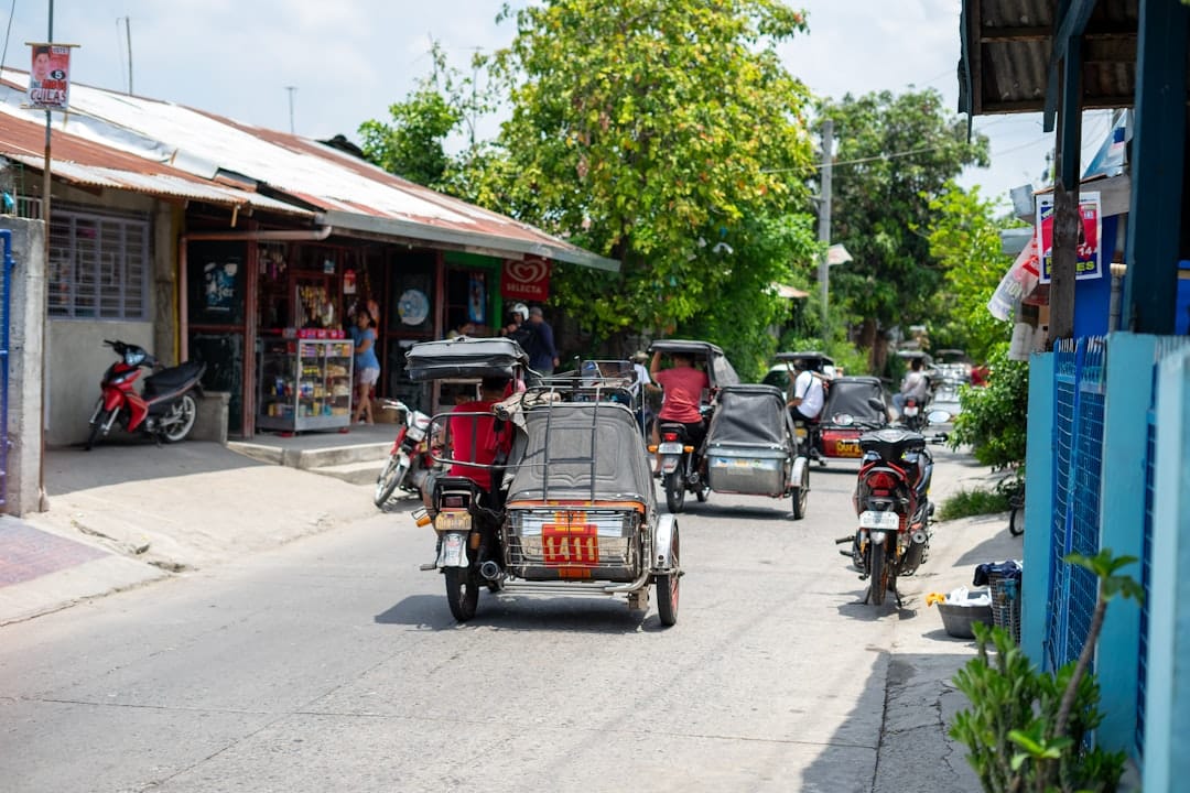
Google Maps prices a Negros journey the way it prices a freeway: distance divided by an average speed the island doesn’t have. The real average on the national highway is 40–50 km/h once towns, tricycles, and trucks have their say, and every trip runs through towns. Here’s how long things actually take, then why.
The big one: Bacolod to Dumaguete
About 230–260 km depending on route, and a genuine 6 hours give or take, not the 4.5 the map suggests.
The southern route (Bacolod – Bago – Kabankalan – Mabinay – Bais – Dumaguete) is the standard Ceres run: 6–7 hours by bus with stops, 5–6 self-driving. The Mabinay stretch through the karst hills is the slow, winding, scenic middle.
The northern route (Bacolod – Silay – San Carlos – Guihulngan – Dumaguete) runs the coast most of the way: similar total time, longer in distance, and exposed to slower coastal-town traffic all the way down the Tañon side.
The Don Salvador Benedicto translink (Bacolod – Murcia – DSB – San Carlos) is the mountain shortcut to the northeast coast: around 2.5–3 hours Bacolod to San Carlos, cool air, and the island’s most scenic highway, then the coast road south from there.
Ceres buses run the Bacolod–Dumaguete routes through the day from Bacolod South Terminal; aircon buses cost more and stop less. There’s no flight between the two cities, and no ferry shortcut: the bus is the trip.
Times from Bacolod
Silay: 30–45 minutes, longer in rush hour; the airport sits between them.
Talisay (The Ruins): 20–30 minutes.
Victorias: about 1 hour.
Bago: 30–40 minutes.
La Carlota: about 1 hour.
Kabankalan: 2–2.5 hours.
Sipalay: 4–5 hours, the last stretch winding along the coast; give it the full 5 by bus.
Hinoba-an: 5–6 hours; this is the far corner of the province.
Cadiz: 1.5 hours. Sagay: about 2. Escalante: 2.5. San Carlos: 2.5–3 via DSB, longer around the north coast.
Canlaon: 3–3.5 hours via La Castellana or via San Carlos.
Times from Dumaguete
Sibulan and the airport: 15 minutes. Bacong: 20. Valencia: 15–20 minutes up the hill.
Dauin: 30–40 minutes. Zamboanguita / Malatapay: 45 minutes.
Siaton: about 1 hour. Bayawan: 2–2.5 hours.
Bais: 45 minutes–1 hour. Manjuyod: a bit over 1. Guihulngan: 2.5–3.
Twin Lakes: about 1 hour total, most of it the mountain access road.
Apo Island: 45 minutes to Malatapay plus 30–40 minutes by boat, so half a day door to door.
Siquijor: 15 minutes to the port plus roughly 1–1.5 hours by ferry depending on vessel.
Cebu: the Sibulan–Liloan crossing is 25–30 minutes by pumpboat or fastcraft, then 3–4 hours by road up to Cebu City; the direct Dumaguete–Cebu City fastcraft, when running, takes the sea route in one go.
Why the map lies here
Every road goes through every town. There is one national highway on each coast, and it doubles as the main street of every municipality it crosses. You don’t bypass Bago or Tanjay; you drive down their high streets behind their tricycles.
Tricycle physics. Town zones run at 20–30 km/h because the vehicle in front is a tricycle carrying a family and a week’s shopping, and the safe overtake comes when it comes.
Cane season. October through April on the Occidental side, the sugar trucks own the highway: slow, wide, heavily loaded, and running day and night to the mills at Victorias and La Carlota. Milling season adds a real margin to every western-side journey.
Buses stop. A Ceres “6-hour” run includes terminal calls at every city and flag-downs between them. The timetable is a rhythm, not a promise.
Rain and mountains. The Mabinay and DSB roads collect fog and downpours that cut speeds in half, and the occasional slip or roadwork on the mountain sections turns a schedule into a suggestion.
The working rule locals use: take the map time and add half again, and for the far south or anything in the mountains, don’t schedule the same day tighter than that. The island rewards the traveller who plans one direction per day and punishes same-day connections, which is exactly why the early bus is always the right bus here.