
Negros Island Region Map
Place Maps
Nine dedicated place maps cover the main cities, towns, and areas across Negros Island Region. Each one documents how that place actually functions — barangay structure, transport access, markets, accommodation, and the daily movement patterns specific to that location.
- Bacolod — city barangays, main roads, food areas, markets, and the districts locals move between day to day. Provincial capital of Negros Occidental and the island’s main transport hub.
- Silay — colonial street layout, heritage houses in the centre, barangays toward the coast and the airport corridor. Fifteen kilometres north of Bacolod.
- Kabankalan — one of Negros Occidental’s larger inland cities, with barangays spread across flat agricultural land and foothills rising toward the island’s interior.
- San Carlos – Sipaway — the port city on Negros Occidental’s east-facing coast and the small island sitting just offshore, with barangays, routes, and local areas on both.
- Sipalay – Cauayan — the southern coast stretch known for bays and coves, with small barangays spread between the shoreline and the interior hills.
- Dumaguete — city barangays, the boulevard, university areas, market zones, and how the surrounding towns of Sibulan, Bacong, and Dauin connect into daily movement.
- Valencia — the upland municipality sitting above Dumaguete, with barangays across cooler elevated land, waterfalls, and the roads connecting back down to the coast.
- Siquijor — small island province in Negros Island Region, six municipalities arranged around a coastal road that circles the island, interior that rises to forest and waterfalls.
- Apo Island – Dauin — dive operators, guesthouses, shore access points, and how movement between the Dauin mainland and Apo Island is organised.
Beaches
Where beaches are actually located across Negros Island — how they are accessed, which barangays they sit within, and how conditions, tides, and road access vary by stretch of coast. The west coast from Sipalay north and the east coast from Dauin to Zamboanguita are the two main beach corridors, with distinct characters and access patterns.
- West coast beach corridor — Sipalay, Cauayan, Hinoba-an bays and coves
- East coast beach corridor — Dauin, Zamboanguita, Siaton shoreline
- Sipalay beach barangays — Sugar Beach, Campomanes Bay access points
- Cauayan coastline — quieter bays, barangay road access
- Dauin beach access — shore entries near dive operators
- Zamboanguita coastline — beach access near Malatapay
- Siaton coastal barangays — southern Negros Oriental shore
- Basay coast — far southern tip, limited road access
- San Carlos coastline — east-facing Visayan Sea shore
- Sagay coast — northern Negros Occidental shoreline
- Siquijor beaches — accessible from the island’s coastal road circuit
Diving – Snorkelling
Where diving happens across Negros Island Region — dive sites, operators, marine sanctuary zones, and the coastal areas where most activity is concentrated. The Dauin–Apo Island corridor on the east coast is the primary dive zone. Siquijor has its own active dive scene on its south and west coasts.
- Apo Island Marine Reserve — protected dive site, outrigger access from Dauin or Malatapay
- Dauin Marine Sanctuary — muck diving sites along the Dauin shoreline
- Zamboanguita dive sites — south of Dauin, continuation of the protected zone
- Siquijor dive sites — Paliton, Tulapos Marine Sanctuary, Salagdoong area
- San Carlos dive area — Sipaway Island surrounding waters
- Sipalay dive sites — reef systems in Campomanes Bay
- Sagay Marine Reserve — protected reef system, northern Negros Occidental
- Dive operators — mapped at their base locations along the east coast
- Marine sanctuary zones — no-take areas with buoy markers on the map
- Shore entry points — access locations for shore diving without a boat
Local Food
Where local food on Negros Island is actually found — karinderya, native dishes, street food areas, and the towns where food culture is tied to local ingredients, farming, and the way people eat day to day rather than how food is presented to visitors. The map covers both provinces and Siquijor.
- Manokan Country, Bacolod — chicken inasal cluster, the island’s most recognised food landmark
- Bacolod inasal district — the broader grilled chicken zone
- Bacolod karinderya zones — morning and midday cooked food areas
- Silay heritage food area — food connected to ancestral house culture
- Dumaguete food corridor — boulevard food stalls, native dessert zone
- Dumaguete native dessert makers — puto, biko, Sans Rival tradition
- Valencia food area — upland food connected to highland farming
- Kabankalan roadside eateries — market-adjacent eating, southern corridor
- Sipalay local food — beach-adjacent cooking, fresh catch to grill
- Siquijor local eateries — municipal market food, coastal cooking
- Malatapay Market food area — Wednesday market cooked food, Zamboanguita
Local Life – Negros Island
Where daily life happens across Negros Island — the markets, barangay centres, food streets, and areas where routines, movement, and local activity are concentrated by time of day and day of week. This layer maps the observable patterns of how the island operates, not what it offers visitors.
- Bacolod Central Market — main island market, most active before 8am
- Dumaguete Public Market — east coast anchor market
- Malatapay Market — Wednesday only, Zamboanguita
- Silay market zone — heritage town daily commerce
- Kabankalan market — southern interior supply point
- Sipalay market area — coastal town daily rhythm
- Siquijor town markets — six municipal markets around the island circuit
- Barangay centres — local governance, health stations, transport nodes
- Jeepney and multicab terminal areas — town-level transport anchors
- Morning food zones — karinderya clusters by town, 6am–1pm
- Evening food activity — boulevard and road stalls, Dumaguete and Sipalay
Local Stays
Where people actually stay across Negros Island — guesthouses, small resorts, and homestays spread across coastal barangays, town centres, and upland areas. The map covers accommodation outside the mainstream hotel sector — pension houses, family-run operations, and places connected to the local rather than the transient economy.
- Bacolod pension house zone — Lacson Street corridor and surrounding streets
- Silay heritage stays — accommodation in and near the heritage district
- Sipalay beach accommodation — scattered along the bay barangays
- Cauayan guesthouses — quieter options on the southern west coast
- Dumaguete pension houses — city centre and boulevard area
- Dauin guesthouses — dive-oriented accommodation along the Dauin shore
- Valencia upland accommodation — cooler highland stays above Dumaguete
- Zamboanguita and Siaton options — southern Oriental coast
- Siquijor accommodation — distributed around the coastal road circuit
- Apo Island — limited accommodation on the island itself; most stay in Dauin
- San Carlos — pension houses serving the port town
Markets
Where markets operate across Negros Island — public wet markets, talipapa, and trading areas by town, with the timing, supply patterns, and how each market connects the surrounding barangays to the town. Every municipality has at least one market. The Malatapay Market in Zamboanguita is the only traditional weekly market operating on a single day.
- Bacolod Central Market — largest, draws from across the province
- Bacolod North Public Market, Libertad Market, Handumanan Market
- Silay Public Market — heritage town market
- Kabankalan Public Market — main southern interior supply point
- Himamaylan Public Market, Guihulngan Public Market
- San Carlos City Public Market — port town market
- Cadiz Public Market — northern Negros Occidental with fish port
- Sagay Public Market, Escalante Public Market
- Dumaguete Public Market — main east coast market hub
- Valencia Market — upland market for highland farms
- Bais Public Market, Tanjay Public Market
- Bayawan Public Market, Siaton Public Market
- Malatapay Market — Wednesday only, Zamboanguita
- Don Salvador Benedicto Market — highland vegetable market
- Siquijor town markets — one per municipality around the island
Scenic Drives
The roads across Negros Island worth travelling slowly — coastal stretches, mountain crossings, and sugar land routes where the landscape, elevation, and pace of movement change noticeably. The map marks routes where the drive itself provides geographic understanding of the island, not just transit between points.
- Silay to Canlaon road — the cross-island mountain route climbing from the sugar plains toward the volcano zone; changes elevation and vegetation dramatically
- Don Salvador Benedicto descent — the road from the highland municipality down to the Bacolod plains; morning produce traffic moves on this road daily
- West coast highway, Kabankalan to Sipalay — the southern corridor through coconut and upland zones before reaching the coast
- Sipalay to Cauayan — the bay-to-bay coastal stretch through the southern coves
- East coast, Dumaguete to Zamboanguita — the coastal road past dive barangays, Dauin, and toward Malatapay and the Siaton interior
- Valencia upland loop — the roads through the elevated barangays above Dumaguete, through waterfalls and highland farms
- Siquijor coastal circuit — the full island road that circles Siquijor through all six municipalities
- North coast, Escalante to San Carlos — the sugar and seaweed corridor facing the Visayan Sea
Slow Food
Where food on Negros Island comes from and where it is eaten — markets, local kitchens, food producers, and the areas where Negrense food culture is most concentrated and least altered by outside influence. The map covers both provinces and tracks the supply chains that move food from farms and fishing barangays into the towns.
- Bacolod inasal and cansi zone — the city’s two signature dishes in their original context
- Victorias Milling Company area — sugar infrastructure and the muscovado tradition
- Manapla muscovado zone — strongest traditional muscovado heritage on the island
- Don Salvador Benedicto highland farms — vegetable supply to Bacolod markets
- Cadiz fish port — northern fishing and seafood supply
- Sagay Marine Reserve edge — seaweed farming and coastal fishing
- Valencia cacao and tablea zone — upland cacao, traditional tablea production
- Dumaguete native dessert zone — puto, biko, bibingka makers
- Malatapay Market — Wednesday market, direct farm-to-buyer trade
- Sipalay seafood grill area — morning catch to roadside cooking
- Bacong, Dauin, Amlan fish landings — east coast fishing supply chain
- Alter Trade Foundation, Bacolod — muscovado-to-fair-trade supply chain
Slow Travel
How movement across Negros Island actually works — distances between towns, transport options by route, and the time and effort involved in getting from one part of the island to another without a private vehicle. The map shows the routes, the transport modes available on each, and where connections require planning.
- Bacolod terminal system — Ceres north and south terminals as the main departure points for the western side
- Dumaguete terminal — the main hub for the eastern side, with connections north toward Bais and south toward Zamboanguita and Siaton
- West coast corridor — Bacolod to Sipalay by Ceres bus; full route takes around 4 hours to the south terminal
- East coast corridor — Dumaguete connections north and south; local buses and vans rather than Ceres on much of this side
- Cross-island routes — the Silay–Canlaon road; no regular bus service; motorcycle or private vehicle only
- Ferry connections — Dumaguete to Siquijor (fast ferry and RORO); Bacolod to Iloilo; San Carlos to Toledo (Cebu)
- Island access — Apo Island by outrigger from Dauin or Malatapay; Sipaway Island by bangka from San Carlos port
- Habal-habal routes — motorcycle taxis connecting coastal barangays and upland barangays where jeepneys do not reach
Transport
How transport is organised across Negros Island — terminals, routes, and the different modes that connect towns along the coast and across the interior, including ferry links to surrounding islands. The map shows the infrastructure, not the schedule — Ceres bus routes, terminal locations, port connections, and the points where transport modes change.
- Bacolod North Ceres Terminal — Silay, Cadiz, Sagay, San Carlos
- Bacolod South Ceres Terminal — Talisay, Bago, La Carlota, Kabankalan, Sipalay
- Bacolod Port / Banago Sea Port — Iloilo ferry connections
- Bacolod-Silay International Airport — 15km north of Bacolod, in Silay
- Dumaguete terminal — east coast bus and van connections
- Dumaguete Port — Siquijor fast ferry and RORO, Cebu connections
- San Carlos Port — RORO to Toledo, Cebu; Sipaway Island bangka
- Sipalay terminal — southern Negros Occidental bus connections
- Kabankalan terminal — interior and cross-province connections
- Siquijor port — Larena; arrivals from Dumaguete and Cebu
- Dauin bangka landing — outriggers to Apo Island
- Malatapay bangka landing — alternative Apo Island departure point
- Cadiz port — northern Negros Occidental, inter-island connections
- Ceres bus stops — mapped along both coastal highway corridors
Waterfalls – Springs
Where waterfalls and springs are located across Negros Island — how they are reached, which barangays and roads lead to them, and how access changes with rainfall and season. Most are inland, in the upland and foothill barangays behind the coastal towns. Most require a motorcycle or habal-habal from the nearest poblacion.
- Pulangbato Falls — Valencia, Negros Oriental; accessible by road from Valencia town
- Casaroro Falls — Valencia uplands; steep trail descent, requires a guide
- Talong Falls — Valencia area; less visited, longer access road
- Mag-Aso Falls — Kabankalan, Negros Occidental; upland barangay access
- Malatan-og Falls — Don Salvador Benedicto area, Negros Occidental highlands
- Bago River area falls — Murcia barangays above Bago
- Canlaon falls and springs — volcanic zone, Negros Oriental/Occidental interior
- Mabinay cave springs — karst zone, freshwater springs in the cave system
- Siaton upland falls — barangay access behind the Siaton coast
- Siquijor waterfalls — Cambugahay Falls (Lazi), easily accessible from the coastal road
- Apo Island freshwater spring — limited freshwater on the island itself
- Seasonal access — most upland falls are reduced or difficult in dry season (March–May)
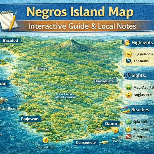
The Insider’s Map of Negros Island
There is no single entry point for understanding Negros Island as a whole. The island is long — around 200 kilometres from Cadiz in the north down to Basay in the south — and the two provinces that divide it do not share a provincial capital, a bus terminal, or a consistent road network. Most visitors arrive with information about one part: Bacolod for the western side, Dumaguete for the east. Very few arrive with a working picture of how the island functions as a whole system.
This map is the top-level orientation layer for the Negros Island Slow Map series. It does not show every place. It shows how the mapped territory is organised — what the sub-maps cover, where on the island each topic sits, and how the different layers relate geographically.
What the Map Shows
Twenty markers are placed across the island, each one corresponding to either a specific place map or a thematic layer in the series. They are positioned where the content actually sits — not at abstract midpoints, but at the geographic zone the relevant map covers.
The thematic markers — Slow Food, Slow Travel, Local Stays, Beaches, Diving, Waterfalls, Scenic Drives, Local Life, Transport, Markets — are placed along the west coast spine, which is where most of the transport corridors and population centres are concentrated. This is not a design choice. It reflects where those systems operate most densely.
The place markers — Bacolod, Silay, Dumaguete, Sipalay, Kabankalan, San Carlos, Valencia Uplands, Siquijor, Apo Island — are positioned at or near the actual geographic location of each place. Each one connects to a dedicated city or place map.
How the Island Is Divided
Negros Occidental occupies the western and northern portions of the island. Its capital is Bacolod. The coastal highway runs south from Bacolod through Talisay, Bago, La Carlota, Kabankalan, Hinoba-an, and Sipalay before reaching Cauayan and the southern tip. Movement between towns on this side is handled mainly by Ceres buses operating from the Bacolod terminal, with local multicabs and tricycles covering barangay-level access.
Negros Oriental occupies the eastern portion. Its capital is Dumaguete. The coastal road here runs north through Sibulan, Bacong, Dauin, and Zamboanguita toward Valencia, and continues further north through Bayawan and Hinoba-an toward the island’s southern tip where the two provincial highway systems converge. The geography is different on this side — the mountains are closer to the coast, road conditions are less consistent, and long-distance bus traffic operates at a lower volume than on the western corridor.
The interior — the mountain range running along the island’s spine — sits largely outside both transport systems. Mount Kanlaon is in the north-centre. The road crossing from Silay toward Canlaon exists but is not a through route for regular travel. The interior barangays are reached from the coastal towns by upland roads, most of them better suited to motorcycles than larger vehicles.
The Place Maps
Bacolod maps the city’s barangays, main roads, food areas, markets, and the districts that locals move between day to day. Two versions exist — one focused on daily movement, one on the broader city geography.
Silay maps the heritage zone, barangay access, and how the town sits in relation to the airport and the Bacolod corridor. Silay is fifteen kilometres north of Bacolod and reached from the same coastal highway, but it functions differently — smaller, slower, oriented around a preserved town centre and the surrounding sugar land.
Dumaguete maps the provincial capital of Negros Oriental — barangays and districts, the boulevard, port area and ferry connections, market and food zones, and the roads connecting to nearby towns including Sibulan, Bacong, and Dauin.
Valencia Uplands maps the highland zone above Dumaguete. The road climbs from the coastal plain into barangays at significant elevation, with different temperature, land use, and pace of movement compared to the coast below.
Sipalay – Cauayan maps the southern coastal area of Negros Occidental — beaches, access roads, and how accommodation and services are spread across a long stretch of coastline with no single defined centre.
Kabankalan maps the mid-west zone — one of Negros Occidental’s larger inland cities, with barangays spread across flat agricultural land and foothills rising toward the island’s interior. It sits on the coastal highway roughly equidistant between Bacolod and the southern tip and functions as the main service town for the inland barangays to its east.
San Carlos – Sipaway Island maps the port city on Negros Occidental’s east coast and the small island sitting just offshore — barangays, the port area, the boat crossing to Sipaway, and the local service areas connecting them.
Siquijor maps the island province to the southeast — accessible by ferry from Dumaguete. It is part of the Negros Island Region administratively but a separate island geographically, with its own road circuit and pace.
Apo Island maps the small marine reserve off the Dauin coast in Negros Oriental — dive operators, guesthouses, shore access points, and how movement between the mainland and the island is organised. The map covers Apo Island access points, Dauin barangays and coastal entry points, and the marine sanctuary zones.
The Thematic Maps
Beaches covers coastal access points across both provinces — where shoreline access works, how it is reached from the main road, and what seasonal and tidal conditions affect it.
Diving – Snorkelling maps the dive sites along the Negros Oriental coast, the Siquijor shelf, and Apo Island, including access points, conditions, and operator locations.
Waterfalls – Springs maps freshwater sites across the island. Most are inland, reached by barangay roads, and accessed by motorcycle or on foot from the nearest poblacion. Access changes with rainfall and season.
Scenic Drives maps road routes where the drive itself is the point — coastal stretches, mountain crossings, and sugar land routes where the landscape, elevation, and pace of movement change noticeably.
Transport maps how movement is organised across the island — terminals, routes, and the different modes that connect towns along the coast and across the interior, including ferry links to surrounding islands. Bus and jeepney terminals, main route coverage, ferry ports, and habal-habal zones are all included.
Markets maps where public markets operate across the island — wet markets, talipapa, and trading areas by town, with notes on what is sold, when activity peaks, and how each market fits into local supply patterns.
Slow Food maps where food on Negros Island comes from and where it is eaten — markets, local kitchens, food producers, and the areas where Negrense food culture is most concentrated and least altered.
Slow Travel maps how movement across the island actually works at pace — distances between towns, transport options by route, ferry connections, and the time and effort involved in getting from one part of the island to another.
Local Stays maps accommodation outside the resort and hotel sector — pension houses, guesthouses, and family-run stays by town and zone.
Local Life maps the daily rhythm infrastructure: markets by opening time, transport nodes, barangay centres, and the points where local routines are most visible.
How to Use This Map
The insider map functions as an index. It shows what exists and where, not what to do. Start here to understand how the covered territory is organised, then move into the specific map that matches what you are trying to understand.
Movement between the maps follows geography. A question about getting from Silay to Kabankalan connects the Bacolod map for the terminal, the Transport map for route and timing, and the Kabankalan map for arrival context. Those three maps together contain more functional information than any single guide covering the same ground.
The maps are updated. Markers are added when new places are documented, and descriptions are revised when conditions change. The data is built on OpenStreetMap infrastructure.
Related Guides
- Negros Island Slow Food Trail
- Slow Travel Map – Negros Island
- Negros Transport Map
- Negros Public Markets Map
- Negros Island Local Life Map
- Local Stay Negros Island
- Negros Beaches Map
- Negros Diving Map
- Negros Waterfalls Map
- Negros Scenic Drives Map
- Bacolod Map
- Dumaguete Map
- Silay Map
- Sipalay Map
- Kabankalan Map
- San Carlos Map
- Valencia Map
- Siquijor Map
- Apo Island Map